How To...
Waymark
- What is a Waymark?
- Waymark Types
- Waymark
Data Sources
- Prepare Waymark
Database
- Export Waymarks as
POI
- Export Waymarks as
Waypoints
- Export Waymarks as
Geocaches
- Record Waymark Visits
- Waymarking Apps
1. What is a Waymark?
- Waymark Definition
- A waymark is a physical location marked by coordinates
(latitude/longitude) and contains unique information defined by its
waymark category.
- An outdoor maze category, for example, might contain information
like price of admission and days of operation, while a statue
category may describe the artist's medium and date of dedication.
- Waymarking was created in response to a large interest in
locationless caches and serves as a new home for the archived
virtual cache category.
2. Waymark Types
- Category
- A waymarking category is a collection of similarly themed
waymarks.
- Each waymark category includes specific submission requirements
and content.
- Waymark categories are managed by individual groups responsible
for all activity within the assigned category.
- There are currently more than a
thousand
user created categories hosting over one
million waymarks worldwide.
- Department
- A waymarking department is a collection of similarly themed
waymarking categories.
- There are currently 15 waymarking departments:
| Animals |
History |
Recreation |
| Buildings |
Measurement Standards |
Signs |
| Business |
Monuments |
Structures |
| Culture |
Nature |
Technology |
| Entertainment |
Oddities |
Waymarking Multifarious |
- Scavenger Hunt
- A scavenger hunt is a game, a personal or shared challenge, to
find a collection of waymarks in a particular area.
- Each scavenger hunt includes a set of waymarks that are randomly
selected based on user selected criteria.
- You must visit each waymark, post your photo at the location,
and log your visit to get credit for that spot.
- After successfully visiting each waymark in the scavenger hunt
set, you will be credited on your profile page.
3. Waymark Data Sources
4. Prepare Waymark Database
- Waymark data downloaded from the resources listed above must be processed
before exporting to a GPSr.
- The example workflows provided below make use of the following
Windows PC software title:
- Tip: If having
difficulty achieving the desired results, carefully recheck all options
for each step in the process.
- Waymark Database Preparation
- Create an empty working directory on your computer.
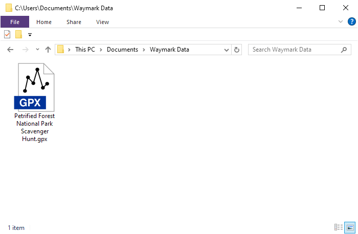
- Download and copy
desired Waymark GPX files to the working directory.
- Start GSAK program and open or create a Waymark
database.
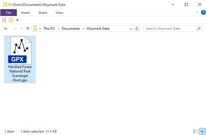
- Drag the *.gpx file
to the GSAK window
and release.
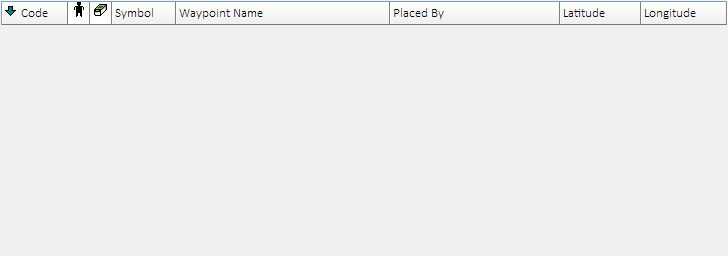
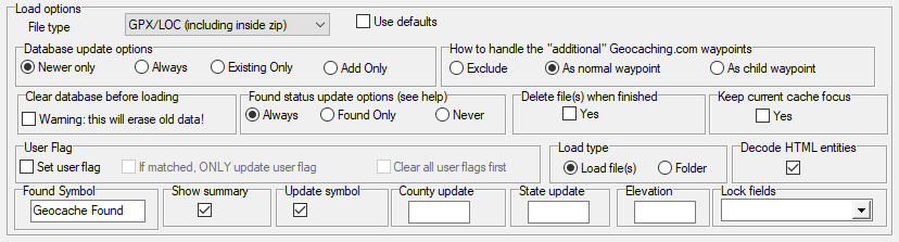
- Configure GSAK import options as displayed below,
and select OK.
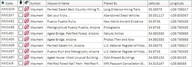
- The resulting GSAK database should appear similar
to what you see below:
-
(displayed columns may vary - configure as
desired)
- Repeat
GSAK database file
import process for each waymark
*.gpx
file when working with multiple downloads.
5. Export Waymarks as POI
-
Recommended only for Garmin devices unable to use
*.gpx or
*.ggz file formats.
-
Provides minimal waymark information (Longitude, Latitude, Code and
Name).
-
POI waymarks can not be searched, filtered or logged using
the geocaching features available on your Garmin navigator.
-
For additional detail and improved functionality, see
Export Waymarks as
Geocaches.
- Open GSAK waymark database
prepared above.
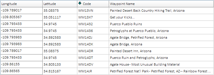
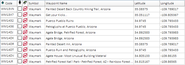
- Select View > Add/Remove Columns..., and configure
displayed columns precisely as shown:
-
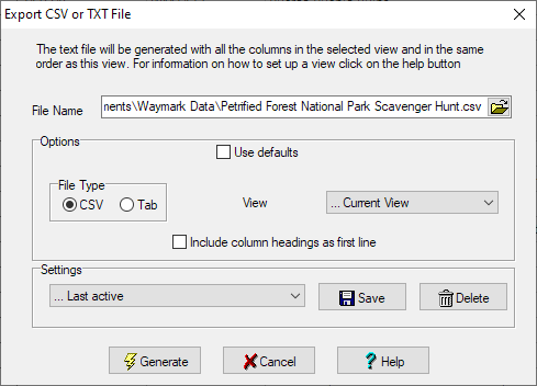
Select File > Export > CSV or
TXT..., edit 'File Name', configure
options as shown, then select Generate.
-
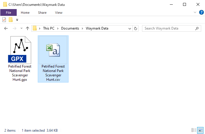
Use the *.csv file
created by GSAK to
Create a Custom POI.
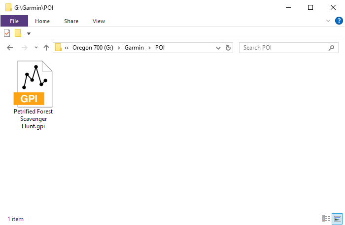
-
A new waymark
*.gpi
file
will now be present in the
[GPSr]\Garmin\POI\
directory:
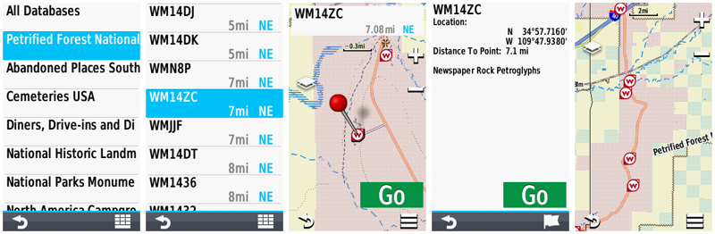
-
Restart the GPSr to view waymarks displayed
as POI:
6. Export Waymarks as Waypoints
-
Due to most devices limiting the total number of waypoints that can be
loaded, this is usually not a reasonable or viable option.
7. Export Waymarks as Geocaches
-
Trick or Treat?
-
While modern Garmin devices do not currently support waymarks, they do
support many traditional geocache types.
-
A majority of these Garmin GPSr will also allow the user to
Personalize Your Map with Custom Symbols.
-
Early navigators did not provide support for geocaches, which had to be loaded
as simple waypoints without any additional information.
-
When geocaching support was first introduced, Garmin simply included two additional
waypoint symbols, 'Geocache', and 'Geocache Found'.
-
Future models would add support for the more common geocache types, displaying each of them using their own unique symbols.
-
On these devices, the 'Geocache' symbol now only appears if/when an
unsupported geocache type is encountered.
-
To enable Waymarking, the Trick is to ensure that all
unsupported geocache types loaded to our device are Waymarks only.
-
And the Treat is the ability to search, view, hunt, and log
Waymarks on our Garmin GPSr just like geocaches!
-
Export to GPX
-
Recommended for Garmin devices that do not
support the *.ggz
file format.
-
Limited by the maximum number of geocaches and
*.gpx files
specified for the device.
-
GPX Waymarks can be searched, filtered and
logged using the geocaching features available on your Garmin navigator.
-
Must copy
desired waymark symbol to [GPSr]\Garmin\CustomSymbols\Geocache.bmp.
-
Do not load
*.gpx and
*.ggz files
that include duplicate waymarks to the same device.
-
To improve device indexing speed and avoid
*.gpx file limitations,
see
Export to GGZ.
-
Open GSAK waymark database
prepared above.
-
Select View > Add/Remove Columns..., and configure
displayed columns as shown:
-
Select Database > Global Replace..., configure options as shown, and select
Replace.
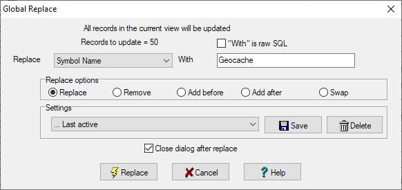
-
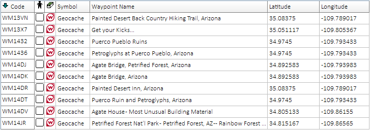
All waymarks in database should now display 'Geocache'
in the 'Symbol' column:
-
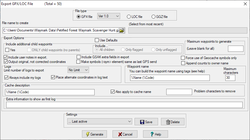
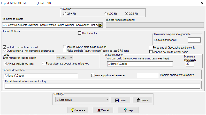
Select File > Export > GPX/GGZ/LOC File...,
edit 'File name to create', configure
options as shown, then select Generate.
-
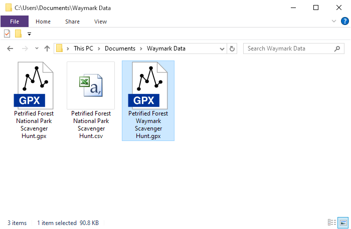
Copy *.gpx file
created by GSAK to the
[GPSr]\Garmin\GPX\
directory, or [microSD]\Garmin\GPX\
directory.
-
Restart the GPSr to view waymarks displayed
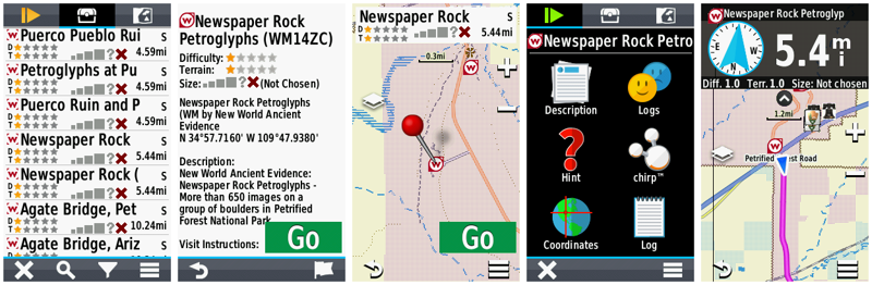
as geocaches:
- Export to GGZ
- Recommended for all Garmin devices that
support the *.ggz
file format.
- Allows the user to load an unlimited number of waymarks and
provides improved indexing performance.
- GGZ Waymarks can be searched,
filtered and logged using the geocaching features available on your
Garmin navigator.
- Must copy
desired waymark symbol to
[GPSr]\Garmin\CustomSymbols\Geocache.bmp.
- Do not load
*.ggz and
*.gpx files
that include duplicate waymarks to the same device.
- For devices that do not support the *.ggz
file format, see
Export to GPX.
- Open GSAK waymark database
prepared above.
- Select View > Add/Remove Columns..., and configure
displayed columns as shown:
- Select Database > Global Replace..., configure options as shown, and select
Replace.
- All waymarks in database should now display 'Geocache'
in 'Symbol' column:
- Select File > Export > GPX/GGZ/LOC File...,
edit 'File name to create', configure
options as shown, then select Generate.
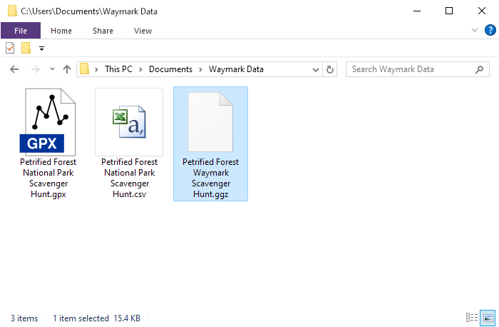
- Copy *.ggz file
created by GSAK to the [GPSr]\Garmin\GGZ\
directory, or [microSD]\Garmin\GGZ\
directory.
- Restart the GPSr to view waymarks
displayed as geocaches:
8. Record Waymark Visits
-
Waymark Logging Protocol
-
Log-in to your user account at
Waymarking.com.
-
Visit the individual waymark page and click on the 'Visit Waymark (Post
Log)' link under Waymark Options.
-
Enter your comment and the date of your visit, then click 'Submit Visit'
near the bottom of the page.
-
While reviewing your submitted visit, you will find an option to 'Upload
Visit Image' under Log Options.
-
Some Waymarks do not require a photo, while others may request you post
one or more specific photos.
9. Waymarking Apps
-
Mobile phone apps that
can enhance your Waymark hunting experience!
-
Android
-
iOS
-
Waymarkly - Simple and Powerful Waymarking.
Experience a whole new way to play the game of Waymarking!