
Where Am I?
- Use the Satellite application to view:
- GPS coordinates
- GPS elevation
- GPS accuracy
- GPS satellite locations
- GPS satellite signal strength
- Current device heading
- View detailed satellite information remotely with Satellite dashboard.
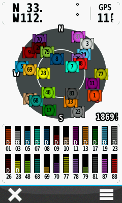
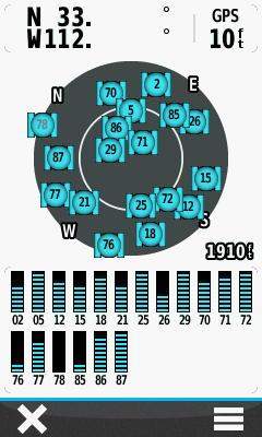
Satellite Information
- There's more information available on the Satellite page beyond current location, accuracy and elevation.
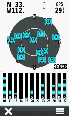
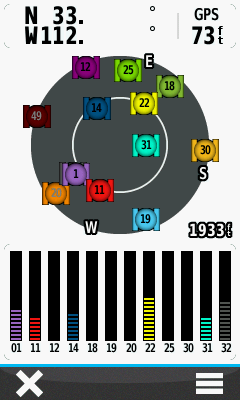
Satellite Map
- Determine satellite location relative to your current position:
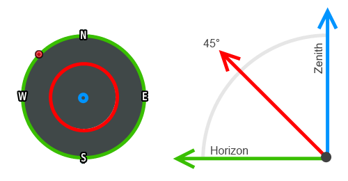
- Zenith: Satellites located directly overhead provide better accuracy when calculating vertical position.
- Elevation: Most visible satellites are found midway in the sky and are best used to determine horizontal position.
- Horizon: Satellites near the horizon are more sensitive to geographic obstructions and therefore less reliable.
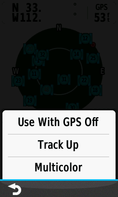
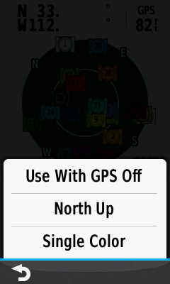
- [Track Up] The compass will function normally with the current heading centered at the top of the screen.
-
[North Up] The traditional compass is locked 'north up' with
 serving as a dynamic heading indicator.
Signal Strength
- Satellite signal acquisition sequence and signal:noise ratio status:
 |
 |
 |
 |
|
|
|||||||
|---|---|---|---|---|---|---|---|---|---|---|---|---|
 |
 |
 |
 |
 |
 |
|||||||
| ================= |
===== |
===== |
===== |
===== |
===== |
|||||||
| A |
B |
C |
D |
E |
F |
- A: Searching for a known satellite signal.
- B: Satellite signal has been located.
- C: Downloading information from satellite.
- D: Satellite data contributing to location calculation.
- E: SBAS information located but not yet applied.
- F: SBAS information has been applied and satellite data is Differentially corrected.
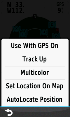
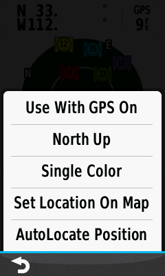
Use With GPS On
- Equipped with a high-sensitivity WAAS-EGNOS/GLONASS enabled GPS receiver and HotFix satellite prediction, the Oregon 6x0 locates your position quickly and precisely, and will maintain its GPS location under heavy cover and in deep canyons.
- GPS, GPS + GLONASS, and WAAS/EGNOS can be enabled/disabled in [Setup > System].
- Select [Single Color] to use day/night colors selected in [Setup > Appearance].
- Choose [Multicolor] to visually enhance satellite map and corresponding signal strength bar association.
GPS
 |
 |
 |
 |
|||||
|---|---|---|---|---|---|---|---|---|
| North Up Single Color WAAS Enabled |
Option Menu |
Track Up Multicolor WAAS Disabled |
Option Menu |
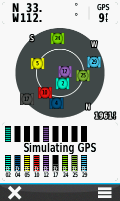
GPS + GLONASS
 |
 |
 |
 |
|||||
|---|---|---|---|---|---|---|---|---|
| North Up Multicolor WAAS Enabled |
Option Menu |
Track Up Single Color WAAS Disabled |
Option Menu |
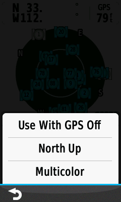
Use With GPS Off
- Disable the Oregon 6x0 GPS receiver to simulate your location, navigation, and other activities.
- Select [Single Color] to use day/night colors selected in [Setup > Appearance].
- [AutoLocate Position] clears saved satellite signal information and begins a new search for local signals.
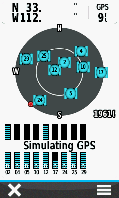
Simulated GPS
 |
 |
 |
 |
|||||
|---|---|---|---|---|---|---|---|---|
| North Up Single Color |
Option Menu |
Track Up Multicolor |
Option Menu |
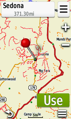
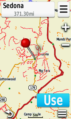
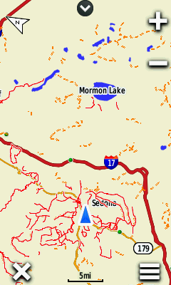
Set Location On Map
 |
 |
 |
 |
|||||
|---|---|---|---|---|---|---|---|---|
| Zoom, Pan & Drag the map to 'Pin' the desired location |
Select [Use] |
Map application displays position at selected location |
Zoom in and explore! |