|
|
|
|
|
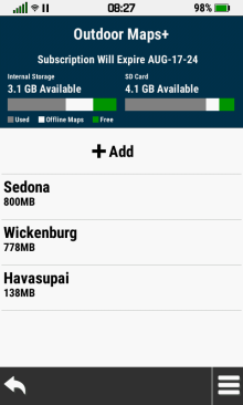
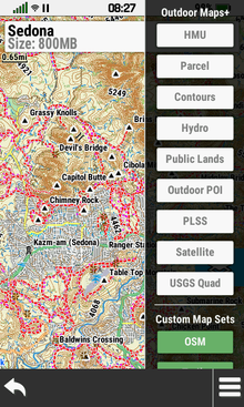
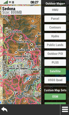
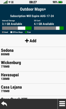
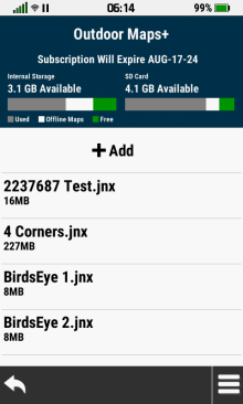
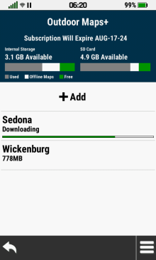
Map List |
|
|
|
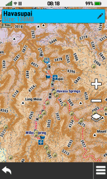
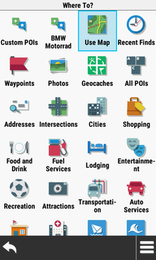
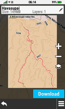
View Map |
- Select individual map layers independantly to view
available map data
|
 |
 |
 |
 |

 |
 |
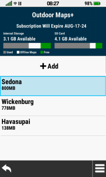
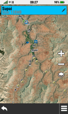
Select Desired Map |
Map Location is Displayed |
|
View Available Maps |
Option
Menu |
|
|
|
|
 |
 |
 |
 |
 |
Toggle Desired Maps, |
Selected Maps, Map Sets |
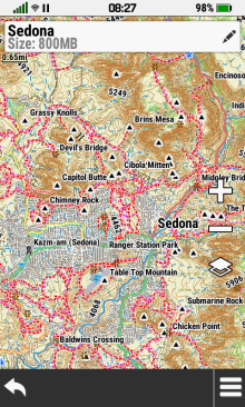
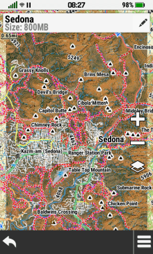
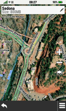
Pan
and Zoom Map |
|
Open
Map Layer Menu |
Map Sets and Map Layers |
and Map Layers are Displayed |
to View Map Details |
|
|
|
|
|
|
|
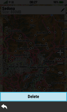
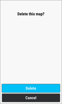
Delete Map |
- All map layers for the selected map will be permanently
deleted
|
 |
 |
 |
 |
|
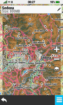
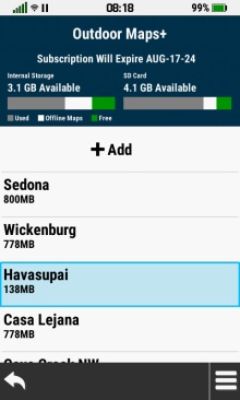
Select Desired Map |
|
[Delete] |
[Delete] |
|
|
|
|
|
|
|
|
|
|
Rename Map |
|
|
 |
 |
 |
 |
|
Select Desired Map |
Select Map Info Box |
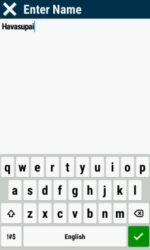
Edit Map Name |
Selected Map |
|
|
to Edit Map Name |
 |
Name is Updated |
|
|
|
|
|
|
|
Edit Map |
|
|
 |
 |
 |
 |
|
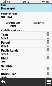
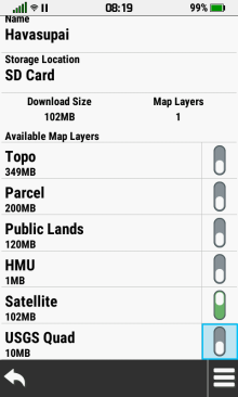
Select Desired Map |
Select Map Info Box |
Edit Map
Name |
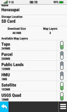
Toggle Map Layers |
|
|
to Edit Map Details |
as Desired |
as Desired |
|
|
 |
 |
 |
 |
 |
[Update] |
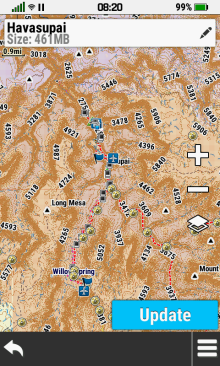
Map Data is Loaded to Device |
Map Download is Complete |
|
|
|
|
|
|
|
|
|
|
|
|
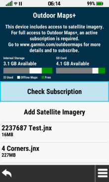
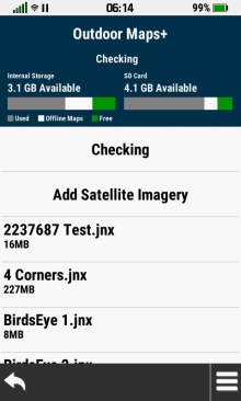
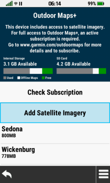
Check Subscription |
- Verify Outdoor Maps+ subscription status
|
 |
 |
 |
 |
|
[Check Subscription] |
Checking... |
Valid Subscription Found |
No Active |
|
|
|
|
Subscription Found |
|
|
 |
 |
 |
|
|
[OK] to Exit |
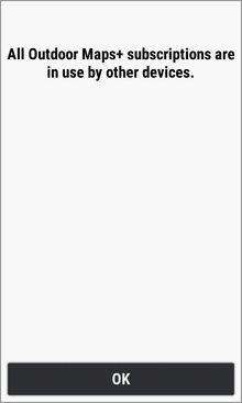
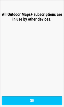
Subscription Currently |
[OK] to Exit |
|
|
|
Assigned to Another Device |
|
|
|
|
|
|
|
|
|
|
|
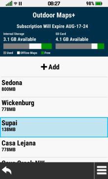
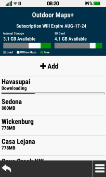
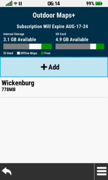
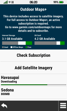
Add Maps |
|
|
|
With Subscription |
- Download available Outdoor Maps+ subscription map data
and subscription-free satellite imagery
|
 |
 |
 |
 |
[ Add]
Add] |
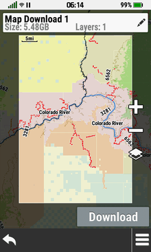
Choose a Category and |
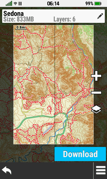
Pan
and Zoom Map |
Select Map Info Box |
|
|
Select Desired Location |
as Desired |
to Edit Map Details |
|
|
 |
 |
 |
 |
|
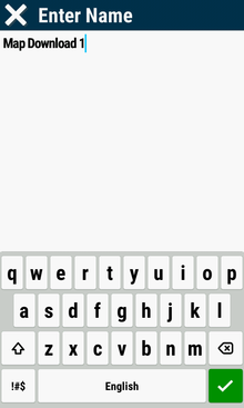
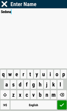
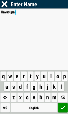
Select Map Name |
Edit Map Name |
|
Map Name is Updated |
|
|
|
|
|
|
|
 |
 |
 |
 |
|
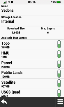
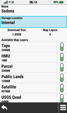
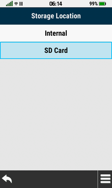
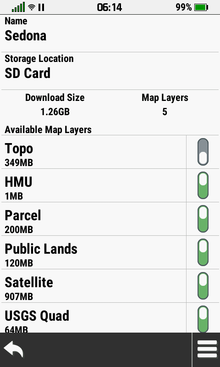
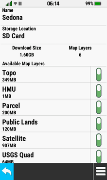
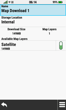
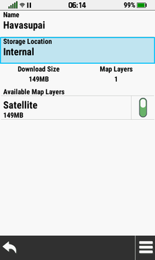
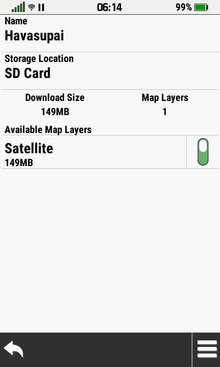
Select Storage Location |
Select Desired Location |
Storage Location is Updated |
Enable or Disable Available |
|
|
|
|
Map Layers as Desired |
|
|
 |
 |
 |
 |
|
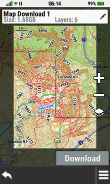
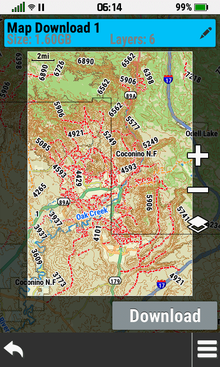
Download Size and Layer Count |
 |
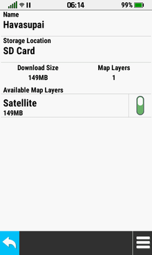
[Download] |
[OK] |
|
are Updated in Real Time |
|
|
|
|
|
 |
 |
 |
 |
|
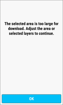
Adjust Map Boundaries |
[Download] |
Map Data is Loaded to Device |
Map Download is Complete |
|
and/or Map Layers to |
|
|
|
|
Acceptable Download Size |
|
|
|
|
|
|
|
|
|
|
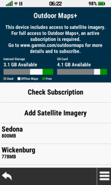
Without Subscription |
- Download subscription-free satellite imagery
|
 |
 |
 |
 |
|
[Add Satellite Imagery] |
Choose a Category and |
Pan
and Zoom Map |
Adjust Map Boundary to |
|
|
Select Desired Location |
as Desired |
Acceptable Download Size |
|
|
 |
 |
 |
 |
|
Select Map Info Box |
Select Map Name |
Edit Map Name |
|
|
to Edit Map Details |
|
|
|
|
|
 |
 |
 |
 |
|
Map Name is Updated |
Select Storage Location |
Select Desired Location |
Storage Location is Updated |
|
|
|
|
|
|
|
 |
 |
 |
 |
|
|
[Download] |
Map Data is Loaded to Device |
Map Download is Complete |
|
|
|
|
|
|
|
|
|
|
|
|
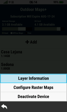
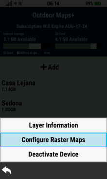
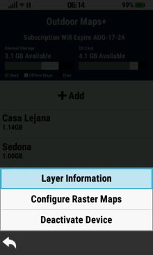
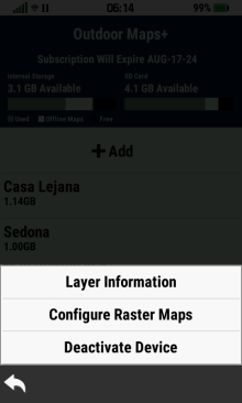
Option Menu |
- Access additional Outdoor Maps+ functions
|
 |
 |
 |
 |
|
|
[Layer
Information] |
[Configure
Raster Maps] |
[Deactivate
Device] |
|
Option Menu |
|
|
|
|
|
|
|
|
|
|
|
|
Layer Information |
|
|
 |
 |
 |
 |
|
|
|
|
|
|
[Layer
Information] |
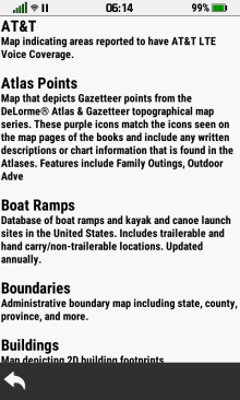
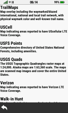
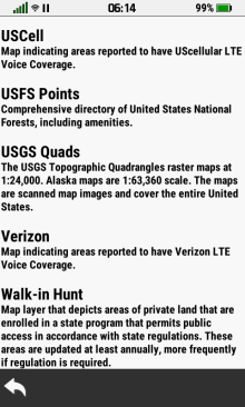
View Layer Details |
View Layer Details |
View Layer Details |
|
|
 |
 |
 |
 |
|
|
|
|
|
|
View Layer Details |
View Layer Details |
View Layer Details |
View Layer Details |
|
|
 |
 |
 |
 |
|
|
|
|
|
|
View Layer Details |
View Layer Details |
View Layer Details |
View Layer Details |
|
|
 |
 |
 |
 |
|
|
|
|
|
|
View Layer Details |
View Layer Details |
View Layer Details |
View Layer Details |
|
|
 |
|
|
|
|
|
|
|
|
|
View Layer Details |
|
|
|
|
|
|
|
|
|
|
Configure Raster Maps |
|
|
|
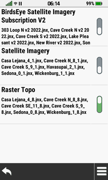
Map List |
- View available raster map collections
|
 |
 |
 |
|
|
|
[Configure Raster Maps] |
|
|
|
Option
Menu |
|
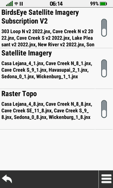
View Available Raster Maps |
|
|
|
|
|
|
|
|
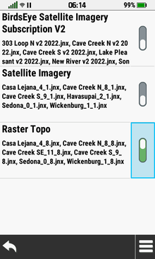
Enable Raster Map |
- Enabled raster map layers are displayed on the Map page
- Raster map layers can also be enabled directly from the
Map Layer Menu
|
 |
 |
 |
|
|
Desired Map is Disabled |
Select Disabled Map Toggle |
Map is Enabled |
|
|
|
|
|
|
|
|
|
|
|
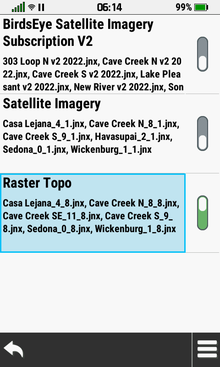
Disable Raster Map |
- Disabled raster map layers are not displayed on the Map page
- Raster map layers can also be disabled directly from the
Map Layer Menu
|
 |
 |
 |
|
|
Desired Map is Enabled |
Select Enabled Map Toggle |
Map is Disabled |
|
|
|
|
|
|
|
|
|
|
|
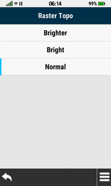
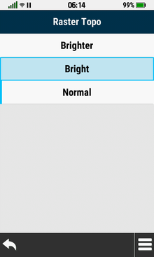
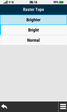
Raster Map Brightness |
- Configure desired Map page display brightness for
selected raster map imagery
|
 |
 |
 |
 |
|
Select Desired Raster Map |
Current Status is Displayed |
[Bright] |
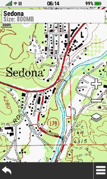
Raster Map Displayed 'Bright' |
|
|
|
|
|
|
|
 |
 |
 |
 |
|
[Brighter] |
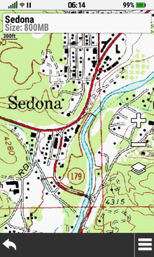
Raster Map Displayed 'Brighter' |
[Normal] |
Raster Map Displayed 'Normal' |
|
|
|
|
|
|
|
|
|
|
|
|
Deactivate Device |
- Deactivate Outdoor Maps+ subscription
|
 |
 |
|
|
|
|
[Deactivate Device] |
|
|
|
Option
Menu |
|
|
|
|
|
|
|
|
|
