-
Basic forecasts provide 2 days (48 hours) of data:
-
Day 1: Forecast information is reported in 2 hour intervals for the first 24 hours.
Day 2: Forecast information is reported in 6 hour intervals for the remaining 24 hours.
-
Day 1: Forecast information is reported in 1-2 hour intervals for the first 24 hours.
Day 2: Forecast information is reported in 3-6 hour intervals for the next 24 hours.
Days 3-7: Forecast information is reported in 12 hour intervals for the remaining 5 days (120 hours).
-
Marine forecasts provide 7 days (168 hours) of
data reported in 6 hour intervals, and include wave height,
ocean current, and visibility details.
-
Basic Marine forecasts also include Basic land forecast information.
Premium/Extended Marine forecasts also include Premium/Extended land forecast information.
Note: Marine forecast information may only be available for locations that are a minimum of 5 miles from shore.
-
Basic (non-marine) inReach weather forecasts cost 1 message against your plan per request.
Premium/Extended and Marine inReach weather forecasts add $1.00 per request to your next inReach invoice.
-
All inReach weather forecast charges incurred are automatically applied to your next inReach invoice.
-
Land forecasts are powered by Dark Sky, a leading provider of global weather data.
Marine forecasts are based on OCENS premium marine weather data.
-
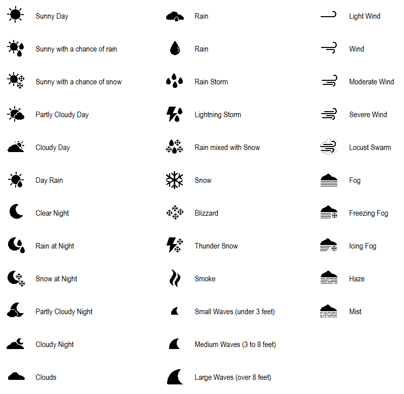
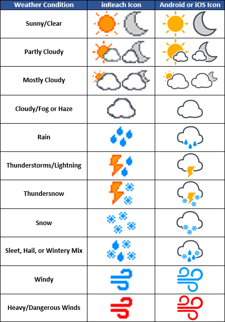
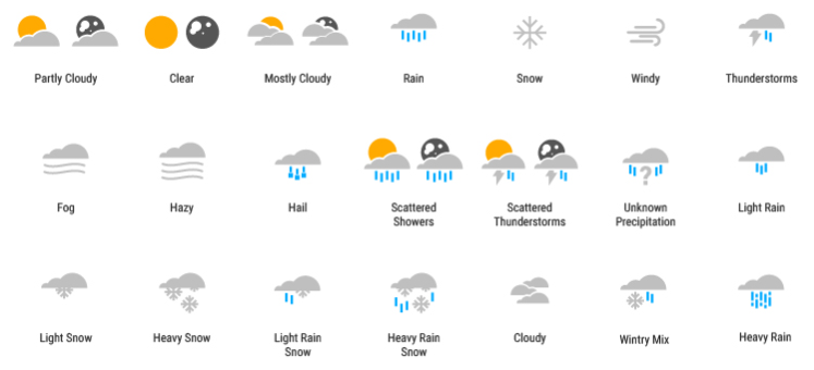
The diagrams below include most of the icons you are likely to see in an inReach weather report.
Note: inReach weather reports that include multiple statuses will display the icon for the most severe weather event.
-
inReach SE/SE+ and
Explorer/Explorer+
-
GPSMAP 66i/86i/86sci and
Montana 700i/750i
-
inReach MINI and
Messenger