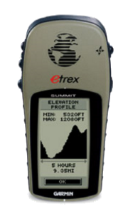
Summit
010-00212-00
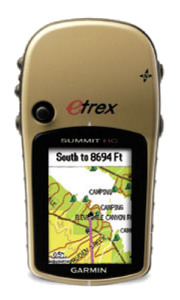
Summit HC
010-00633-00
| 5.3 oz (150 g) with batteries |
| 1.3" x 1.7" (3.3 x 4.3 cm) |
13 hours (GPS + Compass)
|
Summit 010-00212-00 |
Summit HC 010-00633-00 |
|||
| General | ||||
| Unit Dimensions | 2.0" x 4.4" x 1.2" (5.1 x 11.2 x 3.0 cm) | 2.2" x 4.2" x 1.2" (5.6 x 10.7 x 3.0 cm) | ||
| Weight |
|
5.5 oz (156 g) with batteries | ||
| Display Size | 1.1" x 2.1" (2.8 x 5.4 cm) |
|
||
| Display Resolution | 64 x 128 pixels | 176 x 220 pixels | ||
| Display Type | 4 level gray LCD | 256 level color TFT | ||
| Touchscreen | No | |||
| Waterproofing | IPX7 | |||
| Floats | No | |||
| Battery | 2 AA | |||
| Battery Life | 22 hours (GPS Only) 13 hours (GPS + Compass) |
14 hours | ||
| Operating Temperature | 5° to 158°F (-15° to 70°C) | |||
| GPS Antenna | Patch | |||
| GPS Chipset | Garmin | MTK | ||
| High Sensitivity GPS Receiver | No | Yes | ||
| GNSS Network | GPS + WAAS | |||
| Interface | Serial | mini USB | ||
| Maps and Memory | ||||
| Basemap | No | Yes | ||
| Preloaded Map | No | |||
| Ability to Add Maps | No | Yes | ||
| Garmin Custom Maps | No | |||
| Garmin BirdsEye Maps | ||||
| Internal Memory | No | 24 MB | ||
| Accepts Data Card | No | |||
| Custom POIs | ||||
| Waypoints | 500 | |||
| Routes | 20 | 50 | ||
| Track Log | 10,000 points | |||
| Saved Tracks | 10 | 20 | ||
| Automatic Routing | No | |||
| Sensors | ||||
| Electric Compass | Yes (2-axis) | |||
| Barometric Altimeter | Yes | |||
| UV Sensor | No | |||
| Microphone | ||||
| Outdoor Recreational Features | ||||
| Geocaching Friendly | No | |||
| Outdoor GPS Games | ||||
| Flashlight | ||||
| Camera | ||||
| Picture Viewer | ||||
| Photo Navigation | ||||
| Hunt/Fish Calendar | Yes | |||
| Sun/Moon Information | ||||
| Area Calculation | No | Yes | ||
| Tide Tables | No | |||
| Radio | ||||
| Multimedia | ||||
| Wireless | ||||
| Garmin Connect | No | |||
| Smart Notifications | ||||
| LiveTrack | ||||
| Wireless Unit to Unit Transfer | ||||
| Connect IQ | ||||
| Active Weather | ||||