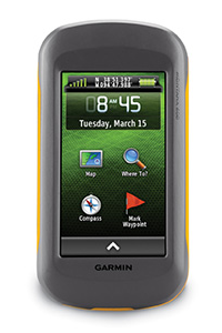
| Model | Part Number | Description |
| 600 | 010-00924-00 | Base Model |
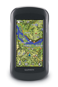
| 610 | 010-01534-00 | Updated 600 with GLONASS support |
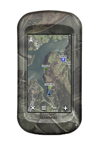
| 600t Camo | 010-00924-21 | Base Model + preloaded 100K Topographic Maps + Camo |
| 610t Camo | 010-01534-01 | Updated 600t Camo with GLONASS support |
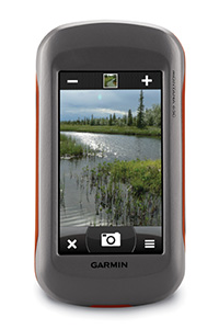
| 650 | 010-00924-01 | Base Model + 5MP Camera |
| 680 | 010-01534-10 | Updated 650 with 8MP Camera + GLONASS support |
| 650t | 010-00924-02 | Base Model + 5MP Camera + preloaded 100K Topographic Maps |
| 680t | 010-01534-11 | Updated 650t with 8MP Camera + GLONASS support |
Model Comparison
|
|
|
|
|
|
| 600 / 610 | 600t / 610t Camo | 650 / 680 | 650t / 680t | |
| General | ||||
| Unit dimensions: | 2.9" x 5.7" x 1.4" (7.48 x 14.42 x 3.64 cm) | |||
| Display size: | 2"W x 3.5"H (5.06 x 8.93 cm); 4" diag (10.2 cm) | |||
| Display resolution: | 272 x 480 pixels (136 ppi) | |||
| Display type: | bright, transflective 65k color TFT, dual-orientation, sunlight readable | |||
| Touchscreen: | Yes | |||
| Weight: | 10.2 oz (289 g) with included lithium-ion battery pack; 11.7 oz (333 g) with 3 AA batteries (Not included) | |||
| Battery: | rechargeable lithium-ion (included) or 3 AA batteries (Not included); NiMH or Lithium recommended | |||
| Battery life: | up to 59 hours | |||
| Integral battery charger: | Yes (Garmin Li-ion 2000 mAh) - No (AA Batteries) | |||
| Waterproof: | (IEC 60529 IPX7) | |||
| Floats: | No | |||
| GNSS Antenna | Patch | |||
| GNSS Chipset | STA5630 | |||
| High-sensitivity receiver: | Yes | |||
| Multi-GNSS | 610/680 | |||
| GNSS Networks |
600/650:
GPS +
WAAS/EGNOS 610/680: GPS + GLONASS + WAAS/EGNOS |
|||
| Interface: | mini USB | |||
| Operating Temperature | -4° to 158°F (-20° to 70°C) | |||
| Charging Temperature | 32° to 113°F (0° to 45°C) | |||
| Maps and Memory | ||||
| Basemap: | Yes | |||
| Preloaded maps: | No | 100K topographic | No | 100K topographic |
| Ability to add maps: | Yes | |||
| Custom Maps: | Yes | |||
| Custom POIs: | Yes | |||
| Internal memory: | 3.64 GB (600) 3.60 GB (610) |
3.64 GB (600t) 7.23 GB (610t) |
3.64 GB (650) 3.60 GB (680) |
7.35 GB (650t) 7.23 GB (680t) |
| Accepts data cards: | Yes (microSD, Max 32GB, Class 4 to 10) | |||
| Waypoints: | 4000 | |||
| Routes: | 200 | |||
| Track log: | 10,000 points per track, 200 saved tracks | |||
| Automatic routing: | Yes (with optional mapping for detailed roads) | |||
| Sensors | ||||
| Electronic compass: | tilt-compensated, 3-axis | |||
| Barometric altimeter: | Yes | |||
| External Antenna: | MCX | |||
| Outdoor Recreational Features | ||||
| Geocaching Friendly: |
Yes (paperless) 600/650: 12,000 geocaches (GPX) 610/680: Millions of geocaches (GPX + GGZ) |
|||
| Outdoor GPS games: | No | |||
| Camera: | No | 5 megapixel, auto focus (650 series) 8 megapixel, auto focus (680 series) |
||
| Photo navigation: | Yes | |||
| Picture viewer: | Yes | |||
| Hunt/fish calendar: | Yes | |||
| Sun and moon information: | Yes | |||
| Tide tables: | Yes (with optional BlueChart maps) | |||
| Area calculation: | Yes | |||
| Wireless | ||||
| Unit-to-unit transfer: | Yes | |||
| Garmin Connect: | No | |||
Behind The Scenes
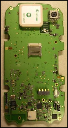
Getting under the skin of the Garmin Montana 650 GPSr.
Montana 6x0 Disassembly
In The Box
- Montana 6x0 GPSr
- Lithium-Ion battery pack
- USB cable
- AC charger
- Manuals
nd