Marine Chart Mode
- Select marine chart drawing mode
- Off
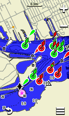
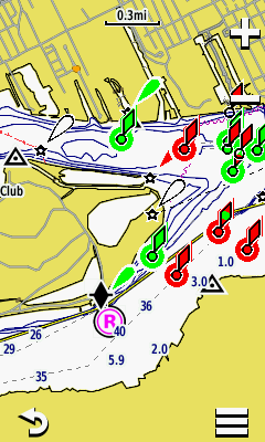
- Nautical (displays various map features in different colors reflecting drawing scheme of paper charts)
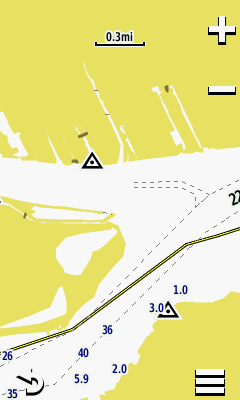
- Fishing (simplifies map presentation for optimal viewing of bottom contours and depth soundings)
- Examples with LakeVu HD and Worldwide Basemap enabled:
 |
 |
 |
||||
|---|---|---|---|---|---|---|
| Off | Nautical | Fishing |
|
Appearance
- Spot Soundings
- On
- Off
-
Light Sectors
- On
- Auto
- Off
-
Symbol Set
- NOAA
- International
-
Safety Shading
- Auto
- Manual
Marine Alarm Setup
- Anchor Drag Alarm
- On (Enter distance)
- Off
-
Off Course Alarm (Tip:
not limited to marine navigation)
- On (Enter distance)
- Off
-
Deep Water
- On (Enter distance)
- Off
-
Shallow Water
- On (Enter distance)
- Off