FIND YOUR WAY IN THIS
BIG, WIDE WORLD
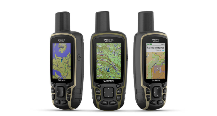
- Explore more with this rugged handheld that offers
multiple frequencies for our most accurate position to
date, a 2.6” color display and preloaded maps.
- Don’t miss a detail
with the large, sunlight-readable color display.
- Lead the way in
challenging locations with multi-band technology and
expanded GNSS satellite support.
- Cross the countryside
with routable TopoActive maps for the U.S. and
Canada.
- Plot your next move
with built-in navigation sensors.
- Organize your
adventure from anywhere with the Garmin Explore
website and app.
- Travel with up to 16
hours of battery life in GPS mode.
EXPANDED GNSS SUPPORT
-
Multi-band technology and expanded
GNSS support
(GPS, GLONASS, Galileo, QZSS and IRNSS) provide
optimal accuracy in steep country, urban canyons and
forests with dense trees.
ABC SENSORS
- Navigate every trail with ABC sensors, including an
altimeter for elevation data, barometer to monitor
weather and 3-axis electronic compass.
PRELOADED TOPO MAPS
- Preloaded TopoActive maps show you
terrain contours, topographic elevations, summits,
parks, coastlines, rivers, lakes and geographical
points.
PUBLIC LAND BOUNDARIES
- An optional display of federal public land
boundaries on topographical maps helps you know that
you’re venturing where you’re supposed to be.
SMART NOTIFICATIONS
- Receive emails, texts and alerts right on your
handheld when paired with your compatible device.
GARMIN EXPLORE APP
- Plan, review and sync waypoints, routes and tracks
by using the Garmin Explore app and website.
- You
can even review completed activities while still in
the field.
MicroSD SLOT
- Using your compatible device and microSD memory
card, conveniently download TOPO 24K maps and hit
the trail, or access HuntView Plus maps to see
public land types and boundaries as well as private
landowner names and boundaries.