Garmin Colorado Common Issues List
Much of this list came from the group of Colorado users who frequent the Groundspeak GPS Units and Software forums. Thanks to everyone who has made a contribution to this page!
Items are labeled (2.30), (2.40), etc, to indicate the most recent version of software where the issue was observed.
Hardware Issues
- Unit receives water damage even though it may not have been immersed for a duration (30 minutes) longer or depth (1 meter) deeper than the IPX7 standard. Early Colorado's (shipped between January 2008 to around March or April of 2008) had improperly sized O-ring seals around the SD card slot. If you have an early unit and suspect damage I would recommend a call to Garmin support. There is also a rumor that Garmin is redesigning the back cover of the Colorado to improve its water resistance. Thanks to Fluteface for the O-ring photo.

- A third version of the SD card slot seal appeared in May 2009. The photo below shows the new seal on a Colorado replaced after warranty repair on July 2009. O-ring has been replaced by seal at the bottom of the battery cover.

- Short battery life with NiMH batteries even with proper battery type set. Most owners who use 2500-2700 mAh NiMH batteries with the battery type set properly to "NiMH" see 8-12 hours of battery life. Significantly less battery life than this or spurious battery low warnings (on fresh batteries) may be a sign of bad hardware. Note: Many owners report poor battery life with alkaline batteries, this may or may not be a hardware related issue but it seems to be the same for most units. [Power]
- Unit freezes at "Loading Maps..." with some SD cards installed. Several problems reported with SanDisk 2GB BE0716406245G cards. [General]
-
Unit sometimes powers on with incorrect time of day and takes longer than usual to acquire satellites. Newer software forces autolocate position to work around the problem but the result can be long acquisition times. Many times this issue is preceded by a freeze at the Garmin banner. Thread. [General]
- New users should leave their Colorado with a clear view of the sky for 20 minutes in order to properly build the almanac data. Owners should rule this out first before assuming they have the issue above. Thread.
- Unit sometimes freezes at the Garmin banner when powering on. Appears related to the time of day issue above. Many times this freeze will be followed by the time of day problem. [General]
- Unit sometimes shuts off immediately or freezes when disconnecting from the 12V car adapter. Normally the user is prompted to determine if the unit should continue to run on battery power or not. Garmin has hinted that this may be a design related problem with power transitions from the power adapter to battery power. Some users report the issue to be worse when batteries are low.
- Soft key or Rock'n Roller presses result in resets or freezes. [General]
-
Jumpy or intermittent behavior when spinning the Rock'n Roller or pressing the middle (enter) button. Many have reported issues with a "jumpy cursor" that moves through menus too quickly or freezes. Garmin seems to be replacing units or providing people with new Rock'n Rollers for people who have these issues. [General]
- Before calling tech support remove the Rock'n Roller and inspect for debris or damage to the magnet on the bottom.
- Intermittent resets or freezes that are not characterized as software issues in the Instability section below. [General]
Crash Bugs
General
- 8/2/08: Unit turns off in image view when going "back" from first picture. Select Shortcuts->Others->Image Viewer with several pictures loaded. When Image Viewer starts the first picture should be visible. Rotate the Rockn' Roller counter clockwise and the unit will shut off (2.6)
Waypoints
- 1/6/09: From the map page pan the cursor and press the enter button to create a waypoint. Select Options>Save As Waypoint, Options>Edit Waypoint, Options>Delete Waypoint and the unit will freeze (2.9)
Navigation
- 3/10/09: When connected to DC power adapter the Colorado crashes on reboot after power off with active autoroute. Load autorouting maps onto the Colorado and connect the GPS to the automotive power adapter. Set to the automotive profile and autoroute to a destination. Press and hold the power button to power off. Press the power button to power back on. Just after the Colorado powers back up when it is recalculating the route it will crash. This happens repeatedly but eventually after powering up/down several times will stop and the unit will boot. (2.9)
Geocaching
- 8/18/08: Certain geocaches which have a space at the end of their name cause the Colorado to freeze during navigation to the cache when displaying the "Arriving at" message. Download the GPX file for this cache or use this GPX file, GCVR92.gpx (which was downloaded directly from Groundspeak on 8/18/08.) Copy this file onto the Colorado. From the Satellite page set Use With GPS Off, select Set Location On Map and set location to about 5 meters away from the geocache icon on map. Then navigate to the map using WhereTo?->Geocaches->GCVR92->Options->Go To Location, the unit will power off. (2.7)
- 8/18/08: Showing the description of certain geocaches will cause the Colorado to freeze. Download the GPX file for this cache or use this GPX file, GCRBM8.gpx (which was downloaded directly from Groundspeak on 8/18/08). Copy this file onto the Colorado. Goto Shortcuts->Geocaches>find and select GCRBM8->Options->Show Description. The unit will freeze or power off. (2.6)
Wherigo
- 8/13/08: The Colorado will shut off playing a Wherigo when a Message Box is displayed when an input box is also displayed. For example, start a timer. When the timer expires, show a Message Box. Now, before the timer expires, display an input box with a few multiple choice options. Wait for the timer to expire and the unit will power off. Even if the main menu is displayed (telling Wherigo to show the main screen before it shows the Message Box), the unit will power off if that input box is still in the background. (2.6)
- 8/13/08: During the playing of some Wherigo cartridges the Colorado will freeze. As of 2.6 this cartridge will freeze the CO entering the proximity of the first zone. Thread. (2.6)
Bugs
General
- 10/24/08: System>GPS is a global setting and cannot be changed per profile. (2.7)
- 7/29/08: The time to archive current data into current.gpx takes too long at startup. When the tracklog is nearly full this can take over a minute. This time is significantly longer than the Oregon. (2.9)
- 6/12/08: If battery is low and the unit is operating on USB power, when USB power is withdrawn the "low battery" message is presented on top of the "switching off in XX seconds" message. The auto-shutoff timer does not run in the background and the unit will remain on until the batteries are completely depleted. (2.6)
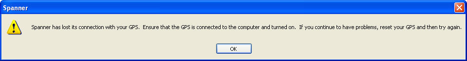
- 5/19/08: When Spanner is connected to the Colorado it will timeout periodically requiring a reconnect. Error message is: "Spanner has lost its connection with your GPS. Ensure that the GPS is connected to the computer and turned on. If you continue to have problems, reset your GPS and try again." Spanner v2.10. (2.6) [General]
- 7/5/08: Might be slightly better with 2.54 but still seeing disconnects after 2-3 minutes.
- 5/29/08: Reports that Garmin may have reproduced this problem and that it will be fixed in Spanner. Still waiting for confirmation.
- 4/15/08: Many users still report problems (ie. very short battery life) with alkaline batteries even though NiMH batteries (2700 mAh) are working well. (2.6) [Power]
Waypoints
- 4/29/09: If the depth field of a waypoint is modified on the Colorado the information is not transferred to Mapsource. It appears that the depth field is not exported as part of the waypoint in the current.gpx file. (2.9)
- 7/29/08: Waypoints imported that contain no <name> tag get exported into current.gpx with illegal characters in the <name> tag. [[space/showimage/NE_locs.gpx|NE_locs.gpx]] demonstrates the problem. Copy this file into [drive]:\Garmin\GPX, disconnect, power on and connect to a computer. The current.gpx file which is created will have two waypoints that have illegal characters in their name fields, these come from the waypoints called "Pierri" and 'Gram C" in the file. (2.9)
- 3/13/08: Create two waypoints on the Colorado called Way1 and Way2. Edit the name of Way2 to be Way1. The Colorado will fail to do the rename (which is okay) AND it will not warn or reprompt the user to enter a different name. (2.7)
POI
- 7/5/08: Search for a Geographic POI by selecting WhereTo?->Geographic Points->Options->Spell... Spell out the name of a POI until a narrowed list is visible and hit "Done". Note that this does not stop the search process immediately as the hourglass is still spinning, however a POI can be selected from the list. If a POI is selected from the list the unit will appear to freeze for a period of 1-2 minutes. If a POI is not selected the hourglass will spin for about the same period of time. (2.6)
Maps
- 7/29/08: With City Navigator NA NT 2009 loaded on a 400t with Topo maps create a profile which just selects the City Navigator maps. Zoom way out. The unit takes a very long time to redraw the map detail or won't redraw the map at all since it seems like there is no basemap which can be used when zoomed out. Enabling Topo 2008 fixes the issue. (2.6)
Navigation
- 9/1/09: In automotive mode the Colorado will never use ferries in car routing mode. Routing settings:
Method: On road for distance.
Avoid: off
Off road transition: auto
MetroGuide Canada v5:
For pedestrian, bicycle or car, it will never navigate using ferries.
With City Navigator North America NT 2008
For car it will never navigate using ferries.
For pedestrian and bicycle, it does navigate using ferries. (2.96) -
5/29/08: Sometimes when you deviate from an auto route using City Nav NT NA 2008/2009 and follow a road parallel to the autoroute which is less than .25 away from the route the unit will not recalculate the route. Thread with pictures. (2.6)
- 7/5/08: This may have improved in 2.54, but users still complain about the CO not rerouting if the route deviates by less than 300-400', usually on a parallel street.
Geocaching
- 1/6/09: Sometimes spell filters on the Geocache lists get remembered when they should be cleared. To reproduce the issue follow these steps: 1) Shortcuts>Geocaches>Options>Spell and spell a partial name to filter the Geocache list 2) Select a geocache, 3) Options>Go to Location, 4) Shortcuts>Geocaches (note at this point the geocache list is NOT filtered by the spelling filter) and select a different Geocache, 5) Options>Log Attempt>Found>Done. Note that the Geocache list is filtered at this point by the spelling done in step 1, the results should not be filtered at this point. (2.9)
- 9/22/08: The Colorado allows the user to enter double quotes (") as part of the field note log text. Since this is the same character used to delimit field note text the site cannot parse the field note and drops it. Not clear if this is a problem with the unit or the site. (2.7)
-
6/11/08: If there are gpx files containing caches in internal memory and a gpx file containing caches on the SD card, changes to the gpx file (i.e. adding a new cache) on the SD card will be missed. An example is provided below (2.51) [Geocaching]
- Create 3 gpx files, call them A.gpx, B.gpx and C.gpx. Each gpx file should contain one unique geocache called G1, G2, and G3, respectively.
- Copy A.gpx and B.gpx to the Garmin\GPX directory in internal memory and on the SD drive, respectively
- Disconnect, power on the CO and verify that Others->Geocache displays G1 and G2.
- Connect and copy C.gpx to the SD drive overwriting B.gpx
- Disconnect, power on the CO and see that only G1 is visible in Others->Geocache. G2 is not (which is correct) G3 is not (which is incorrect).
- The Colorado correctly sees a change to the gpx file since it has removed G2 but it somehow misses the fact that G3 is now available. Subsequent power cycles don't fix the problem. Deleting all gpx files in internal memory and the SD and starting over will work around the issue. Deleting B.gpx, power cycling and copying B.gpx over again onto a clean SD does not fix the problem. It does seem to have something to do with the fact that there is a gpx file in internal memory.
3D View
- 12/11/08: 3D view no longer works properly on the Colorado. The first time you enter 3D View it works, however if you exit and reenter 3D View all you see is a blue screen. This problem is in part caused by setting the Map Detail setting to Most. Setting Map Detail to a lower value can make the issue go away. (2.9)
Wherigo
- 8/13/08: Input fields utilizing multiple choice questions do not work on the Colorado. This cartridge which uses multiple choice questions does not work on the Colorado because the buttons associated with the multiple choice questions are not visible. Thread. (2.6)
Missing Features
Waypoints
- 3/6/08: Newly created waypoints should be added to the top of the Recent Finds list (2.8)
Maps
- 6/13/08: If there are two or more features, POIs, waypoints, etc at the same location on the map page it is only possible to select one with the cursor, if the user selects the set they should be given a pick list of available objects to select. 60CSx (2.6)
Navigation
- 2/9/09: Automatic recalculation of routes should be configurable. User should be able to select automatic, prompted, or off. 60CSx. (2.9)
- 2/9/09: Sensitivity (distance off route) of automatic route recalculation should be configurable. 60CSx (2.9)
- 7/23/08: Selecting and navigating to a map point should add that point to recent finds list without having to create a waypoint. 60CSx (2.8)
Compass
- 6/25/08: The "Hold Level" warning for the electronic compass should be visible on the map and odometer page if the compass is on and the unit is not being held level. The user can see spinning maps or erratic data fields under these conditions without being able to associate it with the compass. 60CSx (2.8)
- 6/25/08: Compass mode (course vs bearing) is not treated as a regular configuration option. Currently course pointer vs. bearing pointer mode can only selected when there is an active navigation destination under the Compass->Options menu, there is no option under Setup->Heading to configure this setting. As a result the configuration is global and cannot be set per profile. (2.6)
Geocaching
- 6/25/08: In geocaching mode the Options menu for the Full Map and Compass screens is missing. If you need to change an option (select a map or change a data field) while in geocaching mode you have to exit geocaching mode goto the page, select options, configure, go back to geocaching mode and select the map or compass page. Oregon. (2.6)
- 3/11/08: Should be able to save a geocache (like POIs) as a waypoint so you can project from it, have it exported to current.gpx, add it to a route, etc. Oregon (2.8)
Feature Request
Compass
- 6/25/08: There is no indicator that the electronic compass is on AND active. Because of the issues that electronic compass can cause if not used properly (calibration/orientation) there should be some indicator to tell the user when a compass is active. (2.8)
Geocaching
- 7/22/08: Geocache names (and GCIDs) are not displayed on the map page unless you hover over the cache. Names or GCID (depending on how the unit is configured) should be displayed (2.8)
Must fix (P2)
- [Waypoints]
-
3/6/08: Shortcuts->Wherigo->[select cartridge]. On the main page of the cartridge only the distance is given to the starting point, there is no bearing. (2.6) [Wherigo]
- 3/10/08: Bearing seems to be given (red arrow) only when moving. The issue may be related to the locations not being available on the CO above.
- 3/5/08: In autorouting mode (City Nav 2008) the guidance text at the top of the map screen should include the distance to turn and the turn arrow for the upcoming turn. This information can be included in the data fields on the map page but with only two data fields the information really should be presented in the guidance text since the data fields are useful for other things like ETA at dest, distance to final, etc. (2.8) [Navigation]
-
3/4/08: When using a location-based Wherigo cartridge there is no way to navigate (autoroute or offroad) to a location in the cartridge. None of the standard navigation features are available on the CO (maps, compass, etc) are available inside the Wherigo player. The only thing you have to work with a distance and a bearing. This should be treated like any other location (maybe a geocache). You should be able to view it on a map, goto it, view the coordinates, etc. Thread. (2.6) [Wherigo]
- 4/21/08: A map has been added to the player but is not available on the Colorado's player yet.
-
3/4/08: Sometimes track segments separated by a power on/off are joined together in the tracklog. This was improved in 2.4 but sometimes there are still jumps in the tracklog connecting consecutive track segments. (2.6) [Tracks]
- 4/4/08: Bogus track connections seem to happen under the following conditions. Move the CO away from the location (call it A) where the CO last had satellite lock before turning it on. Turn the Colorado on and goto (test was performed with autorouting in CityNav) to a destination before the unit has a chance to get satellite lock. Once the unit gets lock a straight track line will be drawn between location A and the location where lock was attained.
- 3/4/08: Cannot select a waypoint or POI and pan around the selected point on the map. Once a waypoint or POI is selected is the map is static (other than zoom) and the only option is "Go". There should be a "view map" option which puts the cursor at the point on map so you can move around the map, select other points, etc. (2.6) [Maps]
- 3/1/08: Should be able to select Geocaches when going to WhereTo?->Options->Search Near (2.6) [Geocaching]
- 3/1/08: Should be able to select POI's when going to WhereTo?->Options->Search Near (2.6) [Waypoints]
- 3/1/08: When scrolling through days on the calendar leap day (Feb 29th) cannot be selected. The cursor skips from Feb 28th to March 1st even though the 29th appears on the calendar. (2.6) [General]
-
2/29/08: A gpx file from for geocache GCTXEX produces garbled text in the description which is impossible to read. Goto the cache page, select "GPX eXchange file", copy this file to the Colorado, select this Geocache and choose Options->Show Description. Notices that the text is garbled and impossible to read the description of the cache. The GPX file which causes the issue is provided here for reference. (2.6) [Geocaching]
- 5/29/08: GC1BEX4 is still garbled in 2.51
- 4/8/08: Still broken in 2.51 and many of the caches which used to freeze on Show Description now have this garbled text issue.
- 3/10/08: Found a way to reproduce this problem with a native groundspeak gpx file. Updated based on that and provided a new file.
- 2/27/08: With guidance set to Off Road the Auto Zoom feature does not work. The map page is not automatically zoomed to the appropriate level once the destination is selected and the zoom level does not change as you near the destination. (2.6) [Navigation]
- Note that in geocaching mode auto-zoom on the map page appears to work correctly.
- 2/26/08: Earthcache/APE icon shows as Traditional caches. All geocache icons should be supported. (2.6) [Geocaching]
- 4/8/08: In 2.51 it looks like it is shown as a Traditional
- 2/25/08: While editing a waypoint which has no depth associated with it select Change Depth->Done w/o making any edits. Even though the waypoint has a depth of zero the summary screen will display "Depth: ((-0.02) (ft))" (2.6) [Waypoints]
- 2/12/08: In CityNav when the Colorado is not navigating to a destination there is no indication of upcoming cross street. (60cs supports this feature). (2.8) [Navigation]
- 2/12/08: With BlueCharts (Atlantic v6.5) when zooming out you can only see depths for the previously visible area. (2.3) [Maps]
- This is probably related to some of the other mapping detail visibility issues below
- 2/9/08: No ability to rename Routes in the Route Planner. (2.8) [Navigation]
- 2/1/08: Pan to a waypoint on the map screen, select it, change the symbol of the waypoint, return to the map page, the new symbol does not appear on the map page (old symbol is still visible). Workaround: Exit the map page and return or scroll the waypoint off the map page and back on again, the waypoint is displayed with the new symbol (2.6) [Maps]
- 2/28/08: Thought this was fixed but this is still broken. If the waypoint scrolls off the map screen and comes back on it seems to have the right symbol but it doesn't immediately after it is changed. Note: the same thing happens with newly created waypoints that have a different symbol than the previous waypoint, I'm assuming it is the same issue.
- 1/31/08: Under Setup->Routing there should be a Guidance Method called Prompted which prompts the user how they want to get to the destination they've selected (off road, on-road-distance,on-road-time). 60cs supported this feature. Workaround: Setup different profiles, but the number of key presses is very cumbersome for what used to take 2-3 presses (2.6) [Navigation]
- 7/23/08: The Oregon has added a feature under WhereTo? which allows quick toggle of on road/off road navigation.
- 1/26/08: Multiple issues during manual archive of partial tracklog (2.6) [Tracks]
- 7/23/08: Oregon Track Manager adds most of these features in a much more robust fashion.
- Can't zoom map during selection of Begin and End.
- Map doesn't redraw when moving Begin and End pins
- Instructions about how to move Begin and End are not clear (press left/right Rock'n Roller key)
- Can't see Begin and End pushpins during move
- Can't swap Begin and End or move End past Begin
- 1/26/08: Cannot see multiple archived/stored tracks on the map page at the same time. Note: You can see the current track and one manually archived track at the same time. (2.6) [Tracks]
- 7/23/08: Added to Oregon.
- 1/26/08: Default backlight in USB mode and after second power button press only works between sunset-sunrise. This feature should be removed or configurable. (2.6) [General]
- 1/25/08: Moun10Biker: No support for custom waypoints symbols. 60cs feature. (2.6) [Waypoints]
- 1/25/08: Manatee87: When routing in City Nav the turn guidance does not show up automatically on all screens. You need to go to Active Route and select a turn in order to see the detailed information. This window should pop the front when the turn alarms happen no matter which screen you are on to display the detailed turn map, distance and time. (2.6) [Navigation]
- 1/24/08: frumious: None of the time of day fields show seconds, particularly on the Status Summary page. Given the accuracy of GPS time many use this feature to set or calibrate other devices (i.e. a camera for geo-referencing photos). (2.6) [General]
- 1/25/08: Workaround: From the trip computer screen select the time of day field which has seconds.
- 1/20/08: Topo maps must be available on DVD to allow trip planning on the PC and allow the user to customize the size of the map image load. This will address some of the performance issue above. [Garmin recorded 1/21/08] (2.6) [Maps]
- 459MB base 300 flash (512MB?) minus around 100MB for maps.
- At a minimum world base map and DEM should be in a separate file.
- 1/20/08: Reset control is not nearly as convenient as the 60cs. On the 60cs you could reset tracks, waypoints and odometer settings from one screen. On the Colorado you need to do it from three places (odometer, waypoint manager and tracks). [Garmin recorded 1/21/08] (2.6) [General]
- 1/20/08: No waypoint averaging when marking a new waypoint. [Garmin recorded 1/21/08] (2.6) [Waypoints]
- 1/20/08: Search and delete by waypoint symbol is not supported. [Garmin recorded 1/21/08] (2.6) [Waypoints]
- 1/20/08: Waypoint symbols aren’t visible in list views (WhereTo? list, waypoint manager, etc) [Garmin recorded 1/21/08] (2.6) [Waypoints]
- 1/20/08: Can't set the "auto-compass-on" trip point speed (i.e. compass turns on below XX mph) [Garmin recorded 1/21/08] (2.6) [Compass]
- 7/1/08: 2.54 claims to improve performance
- 1/20/08: Geocaches don't show up in "Recent Finds" list [Garmin recorded 1/21/08] (2.6) [Geocaching]
- 7/23/08: Oregon adds this feature.
- 1/20/08: Screen is too dim (this might be a hardware issue but I'm wondering if there is a screen brightness setting than might be made available) [Garmin recorded 1/21/08] (2.6) [General]
- 7/1/08: Turning off map shading helps some in 2.54
- 3/10/08: Given the brightness of the screen when attached to the automotive power adapter I still think that Garmin should give control of the brightness to the user. When the backlight is on full with the DC adapter the screen is very readable in all conditions. You cannot get the screen this bright under battery power.
- 1/20/08: Should be able to see the entire set of coordinates when editing a waypoint. Right now you can all see about 7-8 digits worth [Garmin recorded 1/21/08 (2.6) [Waypoints]
- 1/20/08: North up/track up configuration should be available from the map page Options (rather than having to go to Setup->Map) [Garmin recorded 1/21/08] (2.6) [Maps]
- 7/23/08: Oregon adds this feature
Nice to fix (P3)
- 12/23/08: Add support for the log_wpt tag in the groundspeak gpx file so that users can see corrected coordinates in the logs of other users (2.9) [Geocaching]
- 6/25/08: When displaying tide station data the time format should follow the configured format (12/24hr). Currently the tide times always display as 12hr format. Issue Detail. (2.6) [General]
- 6/25/08: Bluecharts g2 Vision maps on a Colorado don't provide depth information for underwater obstructions. Either selecting the obstruction or moving the cursor over the obstruction on the map page should provide depth information, it does not. Issue detail. (2.6) [Maps]
- 6/13/08: Scroll down a list of geocaches, select a geocache to view the description and hit Done. The cursor always returns to the top of the list rather than back at the geocache which was selected (waypoints support this feature) (2.6) [Geocaching]
-
5/29/08: When in auto navigation mode selecting a geocache from the Geocache list in order to read the description should not cancel the navigation. Should be able to read and review geocache information without having to cancel the current navigation. (2.6) [Geocaching]
- 7/2/08: Selecting a geocache from the map to read the description does not cause the same problem, this is a partial work around for nearby geocaches at least.
- 5/19/08: Compass->Options should have an item which allows the user to turn the compass off / auto without having to go to the Setup menu (2.6) [Compass]
- 5/19/08: Elevation Plot->Options should have an item which allows the user to calibrate the altimeter/barometer (like the Compass page) without having to goto Setup->Calibration. (2.6) [Altimeter]
- 5/5/08: The automotive map view has a zoom level display (small wedge shaped slider) at the top of the screen which is visible when calculating long routes. For some reason this doesn't display when the unit isn't calculating routes. (2.6) [General]
- 4/10/08: On European street maps (Germany) the Avoid Highways option under Routing setup will result in avoiding both highways (Bundesstrassen) and motorways (Autobahnen). With the last firmware update of the Zumo and BMW Navigator III plus, it is possible to only avoid only motorways (highways will not be avoided). The Colorado should also have the flexibility to select avoidance of highways and motorways independently. (2.6) [Navigation]
- 4/9/08: No option to bulk delete all routes. Currently you have to delete each route individually (2.6) [Routes]
- 3/27/08: When entering UTM coordinates (Edit Waypoint->Change Location) there is no space between the easting and northing making it hard to track where you are in the entry a very long string of numbers. (2.6) [Waypoints]
- 3/27/08: yogazoo: Ephemeral bodies of water don't display as blue crosshatch in Topo2008 on the Colorado (like they do on other Garmin handhelds). They display as a light yellow area which is hard to see and it is not obviously a body of water because of the color. Thread with example. (2.6) [Maps]
- 3/21/08: POI category names should be at least as long as the 60csx, currently CO supports 14, 60csx supports 17 (2.6) [Waypoints]
- 3/14/08: There is no "prompted" mode when the unit goes off route (ie. Setup->Routing->Off Road Transitions|Guidance Method->Prompted). (Supported by 60csx) (2.6) [Navigation]
- 3/10/08: When the CO truncates a geocache description (or any field) the user should get warned after the gpx file is downloaded (see geocache summary page feature request below). (2.6) [Geocaching]
- 3/10/08: The "Backlight Limit" (On|Off) is a global setting, not profile specific. Changing this setting in one profile results in a change in all profiles (2.6) [General]
- 3/10/08: The order of all distance-based lists (ie. waypoints, recent finds, geocaches) should update dynamically as the unit is moving. (2.6) [General]
- 3/10/08: In routing planner when you view a route on the map the map is static. You should be able to zoom and scroll the map to better view the waypoints, etc. Supported on 60cs(x). (2.6) [Navigation]
- 3/8/08: Need ability to force route recalculation when autorouting. Currently you have to stop the route and refind. (2.6) [Navigation]
- 2/27/08: Geocaches marked Found or Did not Find should be saved as waypoints in the current.gpx file so that they can be archived. (2.6) [Geocaching]
- 2/26/08: Anders: Users should have the option of having the map orient "North Up" when panning in map mode. As of 2.4 when you pan on the map screen the map stays in the mode it was configured "Track up" or "North up". Some users like the map to jump to "North up" mode once they start to pan (regardless of the map setting) others like it to say as is. "Panning Orientation" should be added as a configuration option with two options 1) North up or 2) Use Map Orientation. (2.6) [Maps]
- 2/26/08: jotne: Under WhereTo?->Tides there is no tide graph and no ability to select tide by date as on the 60csx (2.6) [Maps]
- 2/26/08: Geocache type icon should be visible in the geocache list views. Difficulty, terrain and size would be helpful in the list view as well. (2.6) [Geocaching]
-
2/25/08: Cannot add Geocache to leg of a route. (2.6) [Geocaching]
- 7/28/08: Use map feature was added in 2.6 which allows you to select a point near a geocache but not the geocache point itself. Moving to lower priority because there is a workaround.
- 2/25/08: Cannot customize fields of Odometer "Auto View". (2.6) [General]
- 2/25/08: Marky: GCID on geocaches should not be limited to 7 digits -- should display whatever text string is present with a longer limit (i.e. 16 characters) (2.6) [Geocaching]
- 2/2/08: On Recent finds list there should be some indication of the type of each point (ie. waypoint, custom POI, City, Geocache). (2.6) [General]
- 2/2/08: After selection a destination (i.e. Waypoint, POI, Geocache) for navigation you should see the type of point and the symbol you are going to in the summary box at the top of the screen with the green Go button (not just on the map). (2.6) [Waypoints]
-
2/2/08: After selecting a destination (i.e. Waypoint, POI, Geocache) for navigation the destination should be highlighted and brought to the front so it is obvious and the text is always readable. (2.6) [Waypoints]
- 2/25/08: Object is in the center of the screen however the text is not always visible and with a cluster of points it is very hard to distinguish from other nearby points.
- 2/2/08: On the Waypoint/Geocache/POI list views when you select Options->Spell you should not have to enter any characters to get an alphabetical listing of all Waypoints/Geocaches/POIs. Currently you have to enter at least one character which means getting a filtered list of points and they are not in alphabetical order. You shouldn't have to enter any characters and be able see the entire list sorted alphabetically (like the 60cs). In some cases when a point is over 20 miles from your current location this is the easiest way to search when you don't remember the name. (2.6) [Waypoints]
- 2/1/08: When selecting a waypoint under WhereTo? the page that shows the waypoint summary with the Go button shows nearby waypoints but not the track log. (2.6) [Tracks]
- 2/1/08: CO cannot delete or rename archived tracks (manual or automatic) from the GPS. User should be able to rename/delete archived tracks without having to use a PC.(2.6) [Track]
-
1/31/08: When using products like Topo v3 which have a lot of map segments the map screen gets very cluttered when zoomed way out (>120m) because of all the map boarders that get drawn. These should be turned off past a certain zoom level (20-12m?) or just made configurable. (2.6) [Maps]
- 2/2/08: On other Garmin units this is managed by the declutter option that the CO doesn't support. See 1/23/08 issue: Missing declutter options.
-
1/30/08: On the first power on the Colorado sets some basic system parameters like Time Zone and Language. These should be set for all of the default Profiles, not just the first. (2.1) [General]
- 4/10/08: Need to test after hard reset (same procedure is followed then)
- 1/30/08: Lists should scroll around (wrap) rather than having a begin and end. (2.6) [General]
- 1/27/08: Colorado doesn't support night/day color modes. (2.6) [General]
- 1/27/08: No auto archive (ie daily) of tracks on the Colorado (supported by 60csx). Colorado archives based on trackpoint counts and space limits not timestamp. (2.6) [Tracks]
- 1/26/08: Need to add current time to Sun and Moon page. (2.6) [General]
- 1/26/08: Marky: Scrolling through text (as in a cache description) is a page up/page down function, it would be nice if this was a line scroll to make it easier to read. (2.6) [Geocaching]
- 1/25/08: Moun10Bike: When a waypoint is selected the map screen the Colorado does not allow you to pan (search) from that selected waypoint. Workaround: You can search from a selected waypoint, just not from the map page, WhereTo?->Options->Search From->Waypoint (2.6) [Maps]
-
1/25/08: Terracaching gpx files aren't recognized as geocaches, they show up as waypoints. Workaround: Exporting through GSAK will allow you to see one terracache in the Geocache list, but multiple TC's will not be recognized. (2.6) [Geocaching]
- 8/11/08: GSAK export macro can be used to index terracaches on the Colorado.
- 3/14/08: CO uses cache id to index geocaches, cache id is not unique for TC's it is always set to 1.
- 1/24/08: frumious: When you pan on the map it would nice to have the distance and bearing from cursor to position displayed in real time (supported by 60cs). Workaround: A center button press will get you the distance (but no the bearing). (2.6) [Maps]
- 1/24/08: frumious: Multicolor GPS satellite page not supported (supported by 60csx) (2.6) [General]
-
1/23/08: On second press of power button backlight should come on to a previously set backlight level instead of a default low level. (2.6) [General]
- 2/25/08: Works but not across power cycle.
-
1/23/08: No map declutter on/off options (2.6) [Maps]
- 1/24/08: There is a map detail setting. Is this the same? (No)
-
1/20/08: No way to configure the boot screen with name, email, address, etc. (supported by 60cs) [Garmin recorded 1/21/08] (2.6) [General]
- 1/23/08: Workaround: Load a custom background image with your information on it.
- 1/20/08: Can't change the track color (supported by 60cs) [Garmin recorded 1/21/08] (2.6) [Tracks]
- 1/20/08: Accuracy rings not supported on the map page (supported by 60cs) (2.6) [Maps]
-
1/20/08: From the summary cache page you have to read the description before you read the hint, since reading the descriptions is a slow process it would be nice to read the hint directly from the cache summary page. (2.6) [Geocaching]
- 2/25/08: Similarly, now that logs are separate it would nice to have description, hint and logs available from the summary page without having to jump through the description.
New features requests
- 8/3/08: A direct Where To?>Coordinates option is missing as in the Zumo. Currently this only works by editing a new waypoint, storing it, and then going back and selecting "WhereTo?". It takes about 10 steps. [Waypoints]
- 8/2/08: The only time you can edit or view field notes on a geocache is when you log an attempt. A feature should be added to allow the user to edit and view field notes at any time. When selecting a Geocache from the Found or Unfound list there should be an "Edit Field Notes" option which displays the field note, if any, and allows the user to modify the note. [Geocaching]
- 6/13/08: The "Arriving At " alter window should be smaller and transparent, you should also have the configuration option to disable it entirely [General]
- 6/13/08: Image viewer should support rotation, particularly to view landscape mode pictures [General]
- 6/13/08: Detour and Stop Route should not be shortcuts, they should be under the options menu on the active route page (or WhereTo like the Oregon) and map page when a route is active. [Navigation]
- 6/13/08: All configuration should be per profile but certain configuration options like Language, Units, Battery Type, Time Zone should query the user to give them the option to change the option in all profiles. [Profiles]
- 6/13/08: All statistics (like Trip Computer stats) should be saved per profile not global [General]
- 6/13/08: Like Nuvis and other in-car units Colorado should support "Find Near Route" to find points near the currently active route [Navigation]
- 6/13/08: User to should be able to select the map page zoom level where track up orientation switches between north up and track up (60csx) [Maps]
- 5/29/08: Backlight configuration settings for external power and internal battery power should be different. These settings should be profile specific and persisted across power cycles as well. [General]
- 5/29/08: Add configuration item which allows user to specify default behavior when external power is lost: Stay On, Turn Off or Prompted (current mode). [Power]
- 5/29/08: Similar to Nuvi's would like to have the ability to display "Exit Services" when driving along highways if City Navigator is being used. [Navigation]
- 5/27/08: Add support for "avoid ferry" in Routing Avoidance configuration similar to other Garmin devices. [Navigation]
- 5/14/08: The image viewer should have the ability to display the properties of a picture (i.e. name, size, date, etc.) [General]
- 5/13/08: Add support for a low-power tracklog only mode. In order to preserve battery life unit should support a mode where the display is disabled and only records tracklogs to preserve battery life. [Tracks]
- 4/23/08: Add icons for disabled/archived caches (e.g. red "X" through the standard icon) so that caches in the disabled/archived state are easy to recognize. Alternately provide some indication on the first Geocache page to indicate that the cache is in a disabled (or archived) state. [Geocaching]
- 4/15/08: Support transfer of maps, waypoints, routes, tracks using the USB mode in addition to the mass storage mode (similar to 60csx). [General]
- 4/10/08: In areas where the Colorado has DEM it would be nice to have a "elevation above terrain" setting which would be equal to altitude-DEM elevation. [Altitude]
- 3/24/08: Add icon for "write note" geocaching logs. Currently "write note" logs have no icon. [Geocaching]
- 3/21/08: When you plug into an external (DC?) power source there should be a configuration option which sets your profile. Typically this would be used to force the CO into Automotive profile when using an external power source. There could also be a profile set for when the unit switches to battery power. [Power]
- 3/17/08: Support for audio volume, users report turn-by-turn beeps are not loud enough. [General]
- 3/17/08: Support of audio mute (on/off) and different tones for different alerts (similiar to 60csx). [General]
- 3/10/08: Geocaching mode should have a summary page which shows the total number of waypoints loaded and from which files. Other stats would be helpful as well like the total number of finds, DNFs, size of the unfound list, truncated cache descriptions, etc. [Geocaching]
- 3/6/08: The UI design for the edit waypoint screen is very poor. In order to edit a waypoint you should immediately see all of the waypoint parameters and fields rather than having to select each to view it and determine if it needs to be changed. [Waypoints]
- 3/4/08: Should have option to have Monday as first day of week instead of Sunday. [General]
-
3/4/08: There needs to be a "Track Manager" like the "Waypoint Manager" for managing tracks (archiving, saving, trackback, etc). Sticking the track management under WhereTo? doesn't make sense and you can't add a Shortcut to it easily since it is buried under another menu. [Tracks]
- 7/18/08: Like the Oregon's!
- 3/3/08: Should have an option to have the most frequently used items in a list show up at the top of a list (like the Others menu). [General]
- 2/29/08: Need Asian languages (Simplified Chinese) support for maps. [Languages]
- 2/29/08: Map should have the option of setting the data fields to transparent (completely, not just partially transparent like they are now). [Maps]
- 2/29/08: Should have the option of adding more than 2 data fields to the map (3-4 like the 60csx would be better). Suggestion: Replace the Soft Key's at the top with two more data fields. [Maps]
- 2/29/08: Map options menu (like the ability to select the map) should be available during map pan. Currently when panning is started the Options menu disappears. [Maps]
- 2/29/08: Add support for a special Home waypoint and shortcut key press to goto Home. [Waypoints]
-
2/29/08: Support a set of high priority "core waypoints" (on Nuvis this "My Favorites") that can be loaded and managed separately from all other waypoints. Frequently I want to have a "core" set of waypoints always loaded on my GPS: Home, Work, Friend's House, etc. I'd like to be able to delete all other waypoints on the unit (ie. those more temporary waypoints related to Geocaching for example) without deleting the core set. [Waypoints]
- 3/24/08: I think the Nuvi supports something like "My Favorites" which is a similar concept.
-
2/26/08: Need to add special symbol for "did not find" geocaches. Suggestion: Use cache icon with red background. [Geocaching]
- 4/9/08: In 2.51 the DNF geocache icon does not change to a found cache.
- 2/26/08: Handling of multi-cache waypoints need to be improved in geocaching mode. A geocache should be allowed to have multiple (waypoint) destinations which can be added in the field and be marked as found. This would help with Mystery/Unknown caches as well as offset and Multi-caches. [Geocaching]
- 2/26/08: Add support for a file manager on the Colorado which allows the user to load/unload GPX files for different locations, etc. User should be able to load multiple GPX files/pocket queries onto the unit and select which one(s) are active as long as they stay below the 2000 cache limit. Similar for map files and images. [General]
- 2/25/08: Need a quick (key press) profile changer. Currently too cumbersome to change between profiles. [General]
- 2/25/08: Landscape map view for automotive mode. [Maps]
- 2/25/08: Add key lock feature to prevent key presses when unit is turned on but inside a bag, etc. [General]
- 2/12/08: BlueChart symbols for POIs are very large, it would nice to be able to make them smaller (like 276/278) [Maps]
- 2/10/08: Selecting Reset Elevation Data does not clear the elevation plot data. You can only clear the elevation plot by resetting the track log. You should be able to reset the tracklog independent of the elevation plot. [Altimeter]
- 1/30/08: User custom raster image map support [Maps]
- 1/30/08: Support for a lighter global color scheme: menus, backgrounds, maps, etc. This would help because of the dimmer display. [General]
- 1/30/08: Support for more compact lists and menus so more items could be seen at once [General]
- 1/27/08: All data fields that show elevation are based on the altimeter elevation. On the Colorado it would be nice to have Altimeter Elevation, GPS Elevation and DEM Elevation as options for the selectable data fields. [Altimeter]
-
1/26/08: Cannot view Custom POIs on the map page independent of User Waypoints. Need different Zoom Level configurations so that Waypoints can be seen w/o POIs or visa-versa. [Maps]
- 2/25/08: Similarly different settings for Geocaches would be nice. Having this ability would be nice with profiles.
- 1/24/08: The symbol selection page for a waypoint should immediately land you in a row of the 8-10 most recently used icons. [General]
- 1/24/08: During text entry the number of characters to scroll through needs to be minimized. Suggestion is to use a "shift" key that selects a specific range (alpha, ALPHA, num, sym) of characters. In places where the options can be reduced (i.e. N/S for coordinates) numbers and other useless characters should be eliminated. An alternate proposal was to use the up and down keys to select different ranges of characters. [General]
- 1/20/08: Add handling for child waypoints of geocaches. Child waypoints should be associated with a geocache so that they can be found quickly. Removing a gpx file with child waypoints should also result in these waypoints being deleted (like geocaches). Child waypoints could be made into special non-editable waypoints. [Geocaching]
- 1/20/08: Improvements to 60cs geocaching mode (there are many) but being able to select next geocache or parking would be helpful for example. When you complete a geocache you should be given the option to goto the WhereTo? menu, not just Done and Find Next Closest Geocache. Many times my next step is to go (back) to parking. [Geocaching]
- 1/20/08: When you create a new waypoint you should be given the option to goto the waypoint without having to go back to Shortcuts->WhereToGo?. [Waypoints]
- 1/20/08: Status summary screen (with time, GPS status, backlight, etc) should display the outdoor temperature. [General]
- 1/20/08: Add geocache events to calendar (finds, etc) similar to 60csx. [Geocaching]
Language (Internationalization) Issues
- 7/2/08:
- Still some text not translated in German. (2.6)
-
3/19/08: Find-It: German Translations (German.gtt v2.20) [Language]:
- TXT_Go_To_Location_STR_M = Zur Position gehen (current: Zur Postition gehen)
- TXT_Exit_STR_M = Ausfahrt (current: Anschlussstelle)
- TXT_onto_STR_M = auf (current: an)
- TXT_on_STR_M = auf (current: an)
- TXT_on_SPECIAL_STR_M= auf (current: an)
- TXT_Route_Setup_Instruc_STR_S = ? (current : A crazy Translation with many shorted Words, not understandable)
-
3/4/08: Dutch language issues. (German.gtt v2.20) [Language]
- Geocache Options menu: not translated
- After finding a geocache, "Find Next Closest" not translated
- Calendar: "S M T W T F S" is translated in Dutch as "Z M D W D F Z" should be "Z M D W D V Z"
-
2/5/08: Paravan: There is a language localization issue when the Colorado can't get Satellite lock. German users get the following error message in English: "Trouble finding satellites. Continue searching?" Message should be in the language set on the device. (2.4) [Language]
- 2/25/08: Still in 2.4, actually got worse in some cases.
Web Issues
- 9/8/08: Geocaching.com. If a found or not found field note is followed by an unattempted field note the site should ignore the found or not found note.
- 9/8/08: Geocaching.com. Unattempted field notes should be ignored by the site, they should only be used to remove previous found or not found notes on the same cache.
- 5/14/08: Geocaching.com. The log portion of a fieldnote is limited to 500 characters. This should be increased to at least 1500 characters.
- 4/21/08: Geocaching.com. If you are creating logs from fieldnotes and change the date of a log entry to different day the next fieldnote entered as a log will use that day instead of the date in the fieldnote. When a log is created from a fieldnote it should always take the date from the fieldnote instead of the date used by the previous log.
- 4/10/08: Geocaching.com. Conversion from CO field note Zulu time to the user's configured timezone on the site is broken. Timezone on the site was set to EDT (GMT-5) and daylight savings was in affect which would make the difference between user time and Zulu time -4 hours. However, the difference between Zulu time in the field notes and the time used on the site was -12 hours. All field notes uploaded with Zulu time before 12:00 (noon) were dated the previous day, only field notes with Zulu time before 04:00 should have been dated the previous day.
- 4/10/08: Geocaching.com. When field notes are uploaded the site calculates an "ignore logs before" timestamp which should be based on the timestamp of the last field note in the file. With the timezone on the site set to EDT (GMT-5) and daylight savings in effect (GMT-4) the "ignore logs before" timestamp that is displayed is off by -13 hours (it is 13 hours too early).
- 4/10/08: Geocaching.com. When field notes are upload the site can use the "ignore logs before" timestamp which should prevent field notes on or before that time from being uploaded. With the timezone on the site set to EDT (GMT-5) and daylight savings in effect (GMT-4) if you upload the same file twice no field notes should get uploaded on the second attempt. Running this test with these settings you will see that all field notes within 5 hours of the last fieldnote in the file are uploaded a second time.
- 4/9/08: Geocaching.com. Clear all field notes has the effect of removing the "ignore logs before" timestamp for the user account. If you clear all user notes and reload the geocache_visits.txt file, all field notes will be reloaded again.
-
2/8/08: Garmin Connect, Motionbased and Training Center do not support the Colorado.
- 2/9/08: There is a partial workaround for Motionbased. You can upload GPX files directly but this doesn't include heart rate data.
Mapsource/Communicator/POI Loader
- 9/3/08: Using the 2.5.2 POI loader with the Colorado and selecting "Garmin Device" results in the error message below. The workaround is to use the Custom Folder (advanced mode) and set the destination to the Colorado drive.
"There was an error communicating with device. Some devices were found; however, none have the necessary capabilities." - 3/26/08: When using SendToGPS to send geocaches to the SD card of a Colorado the groundspeak cache tags are stripped off so that the geocache does not show up as a Geocache on the Colorado, it shows up as a waypoint. The same cache sent to internal memory includes the groundspeak extensions and does show up as a geocache.
- 3/19/08: Mapsource strips out the sensor data (heart rate and cadence) from tracks.
- 2/5/08: Paravan: Mac only. Using the latest Communicator for Mac to download geocaches from the cache page results in the following error: "There is not enough free disk space on /Volumes/SD_CARD/Garmin/gpx/.Please free up some space and try again". There is plenty of free space and a confirmation that the file is downloaded after the error message but the gpx file is not downloaded to the Colorado. Same issue trying to download to internal memory as well. User has verified that it works on a PC. Sometimes the Mac Communicator doesn't see the SD card as well.
- 1/28/08: Send to Device gives iQue (user name) as an option when selecting the SD card vs. internal storage. It seems to work it is just misnamed.
- 1/27/08: Can't give the Colorado a name in Mapsource
- 4/10/08: In Spanner mode you have the option to change the name but it does not get saved.
Hardware related shortcomings
- 2/9/08: Does not have a dedicated hand lanyard attachment ring. Lanyard can be attached to the carabiner clip but removing the clip every time you need to change batteries or reset (which is fairly frequently) is a pain.
- 1/27/08: USB 1.1 (not 2.0)
- 1/20/08: 2-axis compass, should be 3
- 1/20/08: Screen brightness w/o backlight is very poor compared to the 60cs.
- 1/20/08: No speaker (impossible to play Wherigo cartridges which rely on audio)
- 1/20/08: Outdoor temp readings don't seem to work. I've had the unit outdoors for several hours on days around 25F and have never seen the GPS outdoor temp go less than 50
Resolved Issues
Resolved (in 2.90)
- 6/9/08: Leg distances in the Active Route tool are incorrect when using off road routing. Create simple two leg straight line route between two arbitrary waypoints using off road routing. Select Where To?->Route, select the newly created route and hit Go. Go to Others->Active Route. Selecting the second waypoint in the route should give the first leg distance and estimated time. However the Leg Distance for this leg appears to be the distance from the current location to the second waypoint not the distance between the first and second waypoint. (2.60) [Routes]
- 2/5/09: This seems to be how all Garmins work. I don't understand why but will add a feature request to changes this
-
6/23/08: Colorado consistently crashes when connected to a Virtual OS (VMware and/or Parallels) making it impossible to mount the Colorado in mass storage mode within the VM. This happens with or without an SD card installed. Other Garmin devices work fine. Thread This has been tested with: Garmin Colorado 400t, Garmin Edge 705, Garmin GPSMAP 60CSx on MacOSx v10.5.3 host OS only. (2.40) [General]
- 2/5/09: Cannot reproduce
-
7/2/08: When connecting to a computer the Colorado will hang sometimes if it is not turned on first. To reproduce: turn off the Colorado, connect the Colorado to a computer and allow the unit to enter mass storage mode. The unit will power off after saving data to current.gpx. If the Colorado is turned on prior to connecting (some reports indicate the unit must have satellite lock) to the computer this problem will not occur. This happens only on some units, but there have been many reports of the issue as users upgraded to 2.54. (2.60) [General]
- 2/5/09: Not reproducible any longer
- 7/31/08: Appeared to be fixed in 2.6 but some users are still reporting problems
- 7/7/08: Sometimes removing the SD card changes the behavior of the problem.
-
1/27/08: Some map POIs aren't displayed at the 2m zoom level. Using default zoom level settings (auto) map POIs show up at the 2m zoom level. Zoom to the 3m level (verify no POI's visible) and zoom into 2m. Note the map POI's away from the current location and zoom into 1.2m. At 1.2m some additional map POI's may become visible which were not at 2m. Zooming back out to 2m will cause some map POIs to become visible that were not before, others that were visible are not. Seems to happen to map POI's that are distant from the current location in the 2m and 1.2m zoom levels. Thread. (2.60) [Maps]
- 2/25/08: This seems to be better but not fixed entirely with version 2.4. The centering of waypoints around the cursor is improved but I can still see that some map points are dropped when zooming in and back out again.
- 2/1/08: Map points suffer a similar problem. First, make sure map point zoom level is set so to something like 50m. From the map page zoom out to 50m and zoom down to 2m observing map points near the current location. At 2m observe that very few map points are visible near the current location. Zoom down to 1.2m and notice that many map points (not visible at the previous zoom level) are now visible near the current position. After zooming back out 2m the missing map points are now visible.
Resolved (in 2.80)
- 7/23/08: Position error on the Colorado can sometimes be significant (200'-700') and unit does not recover quickly without power cycling. Thread. Based on well known waypoints, tracks or another GPS the CO can end up in a state where it has significant position error. Challenging satellite conditions seem to trigger the start of the drift. GPS accuracy at most will be <80-90' however the actual error in position can be up to 700'. Normally the fastest way to recover is to power cycle the unit although sitting in the open with good satellite reception for 10-20 minutes will allow the Colorado to recover. (2.70, GPS 2.80) [General]
- 10/24/08: Early analysis shows that GPS firmware 2.80 has at least partially addressed this problem but may not have completely resolved it. After a week of testing I've seen on minor (100-150') drift on at least two occasions, but the frequency and severity of the drifts are much less than with GPS 2.60 firmware. More testing required to see how common it is going to be.
- 7/28/08: Because HCx owners who share the same chipset are seeing the same issue and it is resolved by rolling back to an early version of GPS software (2.30) I'm assuming that is a GPS software issue. Moving back to the Software issues list.
- A sequence of screen captures demonstrating the issue. Position error started at ~430' (9:20a) and over 17-18 minutes dropped to 80'. After 18 minutes the unit was rebooted and it came back with an error of 16'.
- Issue may be power related as there does seem to be an increased frequency with the backlight turned on full.
- Vista HCx owners see a similar problem and both the HCx and Colorado use the MediaTek MT3318 GPS chipset and same version of GPS software.
- It is not clear if this issue is hardware specific but not all owners observe the issue.
- 9/8/08: Similar to the Mac issue with .Trashes below, in some cases Windows can create a [drive]:\Recycled folder on the removable drive and move deleted files into this folder. All files in this folder should be ignored because they are hidden to the user and even though they appear to have been deleted, geocaches from these files still show up on the Colorado. (2.60) [General]
-
3/14/08: Macs creates a hidden .Trashes folder on the Colorado drive (SD and internal memory) in /Volumes/.Trashes . When you delete a gpx file on a Mac it is put into the .Trashes folder that is still visible to the Colorado and causes the contents of the gpx file (tracks/waypoints/geocaches/etc) to still show up on the Colorado. The Colorado should ignore gpx files under the .Trashes directory. (2.60) [Files]
- 4/15/08: Similar issue with deleting Wherigo cartridges
Resolved (in 2.70)
- Alarm and/or barometric pressure data collection sometimes does not work with the unit is powered off. Thread. [Altitude]
Resolved (in 2.60)
- 3/6/08: If you are moving you can not change the Compass Mode from Off->Auto. While moving, change the setting to Auto, exit the Headings setup and reenter Headings setup, you will see that the Compass Mode has been set back to Off (2.40) [Compass]
- 2/25/08: The map feature text size settings don't work for User Waypoints (always small), Street Label (always medium) and Land Cover (always small). (2.51) [Maps]
-
7/7/08: Uploading certain gpx files to the Colorado can corrupt the Colorado requiring a low level recovery. Copy a gpx file to [drive]:\Garmin\GPX. The next time the CO powers on it will power off (screen fade) at the Garmin logo. The only way to recover is to use the low level recovery procedure using a region file. Still needs more characterization but many Czech users are reporting problems. (2.54) [General]
- Issue was with waypoints that contained no <name> tag. 2.60 handles these files without failing
-
5/5/08: Timer functions run very fast. This includes the "Total Time" timer on the odometer page and the stopwatch. Measurements show that the internal timers run from 0.5%-1.0% fast relative to GPS time. Over a 24 hour period an error of 500-700 seconds too fast can be observed. (2.54) [General]
- Stopwatches now run at the same frequency. Trip timers still seem to differ but only slightly.
-
1/25/08: Lightning Jeff: Description for custom POIs doesn't display when selecting the POI (2.54) [Waypoints]
- 2/27/08: Garmin claimed some fixes in this area with 2.40 but I don't see any improvements or changes.
- 3/30/08: Detour function is available during autorouting only when Shortcuts are used - Detour is not shown if "Use Page Loop" is set. This may be related to duplicate entry in menu - see above issue. Post with report. (2.54) [General]
-
1/25/08: Lightning Jeff: From the map screen you can't pan to a location and start a search from that point with out dropping a waypoint and starting a search from the new waypoint. (2.54) [Maps]
- 7/18/08: Select WhereTo?->Options->Search Near->Map Point and this will start a map-based search.
- 2/26/08: When the geocache limit (currently 2000) is exceeded the Colorado should explicitly warn the user. The current behavior is for the Colorado to silently omit some caches. (2.54) [Geocaching]
- 2/25/08: Pan and Select a POI on the map then select Options->Save as Waypoint->Options->Chart Information. This procedure ends up in a blank screen which just a shortcut tab at the top. Note this only seems to happen when selecting the POI on the map, selecting the POI from a list doesn't cause the same issue ("Chart Information") doesn't show up as an option. (2.54) [Waypoints]
- 3/10/08: You can't build a route from the map page by selecting waypoints and adding them to a route. Waypoints can only be added in the route planner. Supported on 60cs(x). (2.54) [Navigation]
- 3/4/08: Duplicate entries show up in the Others menu when autorouting with "Use Page Loop" set. To reproduce: Set "Use Page Loop". Using City Navigator or other routeable map software autoroute a destination. Once in routing mode Page to the Others page and observe the double compass line under the Stop Navigation line. Thread with picture. (2.54) [General]
- 4/10/08: Select Geocaches->[select geocache]->Options->Full Screen Map. Pan to a new location on the map using the RnR and hit enter to select a location on the map and hit enter to Go to that location. The Colorado leaves geocaching mode (expected) but navigation is not active to the selected point (no magenta goto line and navigation data, just waypoint 000 is visible). (2.54) [Geocaching]
-
4/30/08: Cannot show hint for a found Geocache or a found Geocache which is later marked unattempted. Find a Geocache with a hint, mark this geocache as found, note that the "Show Hint" menu option is no longer available. Mark the same cache as unattempted, note that the "Show Hint" menu option is still not available. (2.54) [Geocaching]
- 5/5/08: Reported to Garmin
- 7/2/08: Using "Spell..." to narrow the list of geocaches fails when the list is narrowed to less than one screen's worth of geocaches. Goto Geocaches->Options->Spell... and begin to enter characters to narrow the geocache list. As soon as the list is narrowed to less than one screen of geocaches the text entry disappears (as it should) and briefly returns you to the narrowed list of geocaches. However, almost immediately after this the entire list of geocaches returns (2.54) [Geocaching]
-
3/26/08: Select a waypoint and goto Options->Edit Waypoint->Change Symbol. Scroll up until there is a row of symbols (not a heading like "Civil") at the very top of the display. Move the cursor left to the symbol in the uppermost left corner of the screen and press the left button once. Normally this would wrap up to the next line in this specific case the Colorado will shutdown. (2.54) [Waypoints]
- 4/6/08: Reported to Garmin, Garmin able to reproduce.
-
4/22/08: Create a custom POI database using the POI loader and load it onto the Colorado. Goto Where To->Custom POI and select a POI from the new database and hit Go. Verify the POI shows up on the Recent Finds list. Stop Navigation to the POI. Now remove the POI database by deleting the file, or if it is on an SD card, remove the SD card. Power back on and select Where To->Recent Finds and pick the stale POI from the list. The Colorado powers off. (2.54) [General]
- 5/5/08: Reported to Garmin.
-
7/9/08: If language is set to Czech the unit will restart at some left and right turns while following an autoroute along City Navigator maps. Many Czech users are reporting this problem with 2.54. May have something to do with the Czech equivalents of Turn left/right - "Odbočte vlevo/vpravo". Users have verified that switching the unit to English fixes the problem. (2.54) [General]
- 7/11/08: Modifying the Czech language file to remove special characters also resolves the issue.
- 7/9/08: Verified that the problem occurs on City Navigator NT NA 2009 if an autoroute is followed with the unit in Czech language mode. May have something to do with multiple close turns.
- 7/5/08: Loading a previously saved Wherigo cartridge will cause the Colorado to freeze on page saying "Restoring Cartridge". Under Others->Wherigo select a cartridge and begin to play, quit the cartridge, save your progress and select it again. When asked if you want restore the previously saved cartridge say yes and note that the Colorado will freeze on the "Restoring Cartridge" screen. (2.54) [Wherigo]
-
7/1/08: Deleting a waypoint crashes the Colorado. Select a waypoint->Options->Edit Waypoint->Options->Delete Waypoint (2.54) [General]
- 7/1/08: Deleting waypoints from the Waypoint Manager seems to work
- 4/11/08: gpx files stored on the SD card are reloaded every time the CO starts up. This is different (and confusing) behavior because it works differently from how gpx files stored in internal memory work. gpx files in internal memory are read once and unless they change, they are not read again. gpx files on SD card are reread during every start which has two bad side effects 1) waypoints, tracks, routes can be deleted on the Colorado but the next time the CO boots they will reappear and 2) for large geocaching files the data is reread causing the boot to be slow. (2.51) [General]
Resolved (in 2.54)
- 2/27/08: The backlight limiting feature does not completely work. Setting Shortcuts->Setup->Display->Backlight Limiting to Off only affects the backlight settings at two power bars, the backlight is still controlled once the battery gets to one red bar. Once the battery is at one bar the backlight limiting (and tone disable) message is displayed at the backlight is turned down or off. (2.51) [General]
- 7/9/08: With backlight limiting set to off the backlight will now run on whatever setting you have until the battery dies, truly no limiting. Tones also seem to work all the way until the unit turns off.
-
4/8/08: Sometimes City Navigator NA 2008 NT maps disappear from the map page during a reroute. On a 400t loaded with CN NA 2008 NT enable the CN maps and disable the Topo2008 maps with Automotive View set. Set up an autoroute to a destination and during travel deviate from that route. During the route recalculation the entire map screen goes white with just the blue position cursor visible. Enabling and disabling CN maps has no effect but enabling Topo2008 causes the CN maps to reappear. Topo2008 maps are located in internal memory and CN maps are located on the SD card (full set). The issue seems to be location/route dependent but can be reproduced using the same route and same reroute location. (2.51) [Maps]
- 7/5/08: Cannot reproduce with 2.54, but I have a feeling it wasn't explicitly fixed. Garmin seems to have tweaked the sensitivity on when the CO recalculates the route when you go off route. I believe this prevents the problem from happen above but under the right circumstances might still occur.
- 4/21/08: Happens the same way in North up mode. Zoom level is .3mile and drops to 500ft during recalculation. May have something to do with the fact that a turn alert is happening at the same time as the recalculation.
- 4/9/08: Reported to Garmin
-
1/26/08: No support for proximity rings or proximity alarms. 60cs feature. (2.51) [Maps]
- 7/1/08: Proximity alarms and speed alerts now work.
-
2/26/08: Add the ability to enter simple text logs as part of the field notes capability. [Geocaching]
- 7/1/08: Added feature
-
2/25/08: Map selection settings should work like any other configuration and should "stick" based on profile. They are not. (2.51) [Maps]
- 7/1/08: Resolved
-
3/6/08: The Compass Mode (Auto|Off) is global and not profile specific. (2.51) [Compass]
- 7/1/08: Resolved
-
1/26/08: No support for Trackback. 60cs feature. (2.51) [Tracks]
- 7/1/08: Can tracback the current track
-
1/29/08: Audio off/on controls should be independent for system sounds and alarm clock. Should be able to turn off all sounds except the alarm. (2.51) [General]
- 7/1/08: Partially fixed, audio for alarm will sound no matter what the tone setting is.
-
1/26/08: Several times during Where To?->Tracks navigation the map screen failed to redraw (white screen and cursor). Navigation appeared ok, good satellite lock and coordinates looked valid but "distance to next" both times read something like 800 miles. Stopping navigation and returning to the map screen cleared the problem and got the map to redraw. (2.30) [Tracks]
- 7/1/08: partial redraws fixed.
-
4/18/08: When entering text Dutch language users no longer have the letter "Z" in the alphabet. Thread with photos. (2.51) [Language]
- 7/1/08: resolved
- 2/26/08: Sometimes in map view the bottom or the right 1/4 or 1/2 of the map is not redrawn on the screen. Not reproducible but happens when zooming/panning, sometimes when driving long distances (2.4) [Maps]
Resolved (in 2.51)
- 3/6/08: Certain Wherigo cartridges sometimes cause the Colorado to reset. About 2/3 of the way through this cartridge after the marbles are put in bags a screen comes up which gives some guidance on which trails to take. It says something to the effect of don't go straight, stay on the trails and go around. The first time I ran through the cartridge I read the first page, scrolled down, read the second page and hit OK. When I did that the Colorado reset and powered off. The second time I did this I was saving the cartridge along the way and when I reached this point I didn't bother to scroll down to the second page and hit OK. No reset. Thread. (2.40) [Wherigo]
- 7/5/08: Not sure if this has been fixed but I haven't seen it or heard reports of it for a long time. Assuming it was fixed in one of the rounds of Wherigo player updates.
-
6/5/08: If the user selects a geocache and Options->Go To Location the unit does not route to the geocache, either auto route or straight line. (2.50) [Geocaching]
- 6/5/08: Appears to have been introduced in 2.50 and fixed in 2.51. Leave here until next non-beta release is available.
-
3/8/08: Found geocaches loaded from a gpx file are all put on the Unfound Geocache list. Found geocaches in a gpx file should be loaded immediately onto the Found Geocache list. (2.40) [Geocaching]
- 5/15/08: Found geocaches imported now get put on the Found Geocache list and have a Found Geocache icon.
-
3/25/08: Geocaching.com: Thread. On the fieldnotes page there is a button called "Clear All Field Notes". With 6 fieldnotes uploaded clicking this button has not affect. You need to click "delete log" (shouldn't it be "delete note"?) for each individual note.
- 4/10/08: Fixed but it introduced another bug.
-
3/4/08: Geocaching.com: The date from a fieldnote is not used to set the date of a log that is created from it (the current date or the last used log date is always filled in for the log).
- 4/10/08: Logs always seem to get their field note date now.
-
1/27/08: Can't use Colorado to set PC clock in Mapsource
- 4/10/08: If you have the Colorado in Garmin Spanner mode and connect using the Colorado in USB mode this seems to work
- 1/24/08: Image viewer only displays images on SD card, not from internal memory. (2.40) [General]
- 4/23/08: Fixed, you can view images from just about any directory on the SD card or internal memory.
- 4/8/08: Images will display from the internal memory if there are in the [drive]:\Garmin directory -- needs verification.
- 3/10/08: Sometimes when you select a cache the navigation tools don't work (i.e. the bearing pointer doesn't activate and the data fields are blank). It is not clear what causes the unit to get into this state (it doesn't seem to be cache specific). (2.40) [Geocaching]
- 4/21/08: Based on a poll of users, no one seems to be seeing this issue any longer in 2.51
- 3/24/08: Confirmation from several users that deleting all of the gpx files in the [drive]:\Garmin\GPX directory and restarting clears the issue.
- 3/21/08: Many reports from users on the forum with the "broken navigation to a cache" issue. Most seem to using geocaching mode (goto next geocache). Once the condition happens it seems to affect some caches not all. Hard reset clears the issue. Some reports that deleting all gpx files, restarting, and reloading fixes the issue.
- 1/22/08: The battery meter is unstable. Unit reports low battery but runs for a long time. The meter fluctuates significantly up and down for NiMH. Batteries that are considered dead in the Colorado work find in other GPS's (2.40) [Power]
- 4/15/08: Not sure if this is really fixed but with 2700mAh batteries things have been very stable. Alkaline batteries remain a problem.
- 4/10/08: With 2700mAh batteries I haven't seen this in a long time. The only time I've seen issues is if I switch to a profile that has Alkaline set.
- 2/25/08: In 2.40 battery life is improved but still seeing spurious battery low warnings and 3 bars only minutes later.
- 1/24/08: 2.3/2.6 is reported to fix an issue with high backlight settings and alkaline batteries.
- 1/22/08: Complaints on forum that NiMH battery setting isn’t doing the proper thing – it is claiming the battery dead too early. Dead battery on Colorado works fine in other GPS.
- 4/5/08: Selecting a geocache from the map page causes the current autoroute to get canceled. Using CN NA 2008 NT autoroute to a destination in automotive map view. While autorouting move the cursor on the map page to a nearby geocache and select (hit enter) on the geocache. Select Done and observe that the autoroute has been canceled (no magenta goto line, and no ETA data, although the blue destination pin still shows). A similar operation with a user waypoint or map POI does not result in the autoroute being canceled. (2.40) [Geocaching]
- 4/10/08: Fixed.
- 3/18/08: Viewing Pressure Plot and Barometer Plot at certain zoom levels is broken (or the Colorado ambient pressure sensor is recording spurious low values at power on). To reproduce the problem turn the unit on for a period of several hours and then off for several hours (don't collect pressure data when off). Turn the unit back on and look at either the Pressure or Barometer plot. Zoomed out (time scale >= 6hrs) the plots look fine, but zoomed in (time scale <= 3hrs) points appear on the plot at 1-2mb (normal is around 1000mb). This makes it very difficult to view the plot because the vertical scale becomes useless. The low points in the graph appear to be around the time the unit was turned on. (2.40) [Altimeter]
- 4/10/08: This seems to be fixed in 2.51. More testing required but the graphs for elevation, pressure and barometer seem to be much smoother and I don't see spurious data points in the 1-3mb range.
- 1/28/08: Occasionally when connecting the CO from a PC the CO gets stuck in "Transferring to mass storage mode". When you unplug the USB cable a screen appears indicating power is lost and would you like to continue. At that point the device resets (screen fade). Just plugging the USB cable back into the CO results in the same behavior. In order to get out of this mode you need to let the GPS start without the USB cable attached and plug in the USB cable once it has started successfully. I've seen this happen twice in probably 100 startups. (2.30) [General]
- 4/10/08: Haven't seen the issue above in 2.40 and the issue of 3rd party AC adapters seems to be fixed in Garmin Spanner mode.
- 3/17/08: Plugging/unplugging into certain 3rd party AC adapters (Motorola) still causes the issue. However, I have not had the stuck in transferring to mass storage mode in 2.40.
- 1/31/08: Plugging/unplugging the CO into some USB AC adapters causes a similar issue. Sometimes I see the AC power lost message and then a screen fade reset, other times the CO just freezes on the USB mass storage screen when I unplug the AC adapter.
- 2/28/08: Load a geocache, set the Map Orientation to Track Up, goto the map page and zoom out to 50mi. Note that the map is forced into North Up mode (which is okay). Start a map pan (which holds the map in North Up mode) and zoom back in until you can see the geocache icon on the map. Select the geocache icon on the map to view the geocache information and then quit back out to the map screen by hitting Done. The map orientation configuration will be in North Up mode now. Selecting a geocache on the map should never change the orientation configuration. (2.40) [Geocaching]
- 4/8/08: Fixed
- 1/20/08: GPS always auto-powers off after disconnect to PC. Should go to GPS mode or ask.[Garmin recorded 1/21/08] (2.40) [Power]
- 4/8/08: If you set Setup->System->Interface to Garmin Spanner you will get prompted every time you plug into the PC whether you want to enter USB mode or not. Similarly when you disconnect and the GPS is not in USB mass storage mode you will be asked if you want to leave the GPS on or not.
- 3/4/08: Download the gpx file for geocache GC16RK6 using "Send to GPS" and Show Description for the geocache on the CO. Note that the description is truncated about 1/2 way through. (2.40) [Geocaching]
- 4/8/08: These caches are fixed. Not sure what the new limit is.
- 3/10/08: Similar with GC19GVE
- 3/8/08: Reports on other caches that descriptions are truncated around 4500 characters. Limit should be the same as gc.com (10000? characters)
- 2/29/08: A gpx file from geocache GCY2ZT will cause the Colorado to freeze. Goto the
cache page, select "GPX eXchange file", copy this file to the Colorado, select this Geocache and choose Options->Show Description. The Colorado will freeze, batteries must be removed to restart. The GPX file which causes the issue is provided here. (2.40) [Geocaching]
- 4/8/08: Fixed although a large number of these now have garbled text, being tracked under a different issue.
- 3/10/08: Some caches will work if you strip out all of the html tags.
- 3/10/08: Other caches which have the same problem. Pocket Query or GPX eXhange File download results in the same behavior. GC18KZT, GC18N05, GCK5E7, GCKJEN, GCTCFF. GCY2ZT.gpx
- 2/27/08: The gpx file from geocache GC18H22 will cause the Colorado to power off (screen fade). Goto the
cache page and select "GPX eXchange file". Once the file is downloaded transfer the file to [drive:]\Garmin\gpx and restart. Select this Geocache then choose Options->Show Description. The Colorado will power off. Note: This same cache downloaded through the Communicator will work without any issues.
- 4/8/08: Fixed although many caches with this issue now have garbled text.
- 3/10/08: Setup->Maps->Avoid->Highways does not work with City Navigator. When this option is selected highways (interstates) are used for the route. Similar results with German autorouting maps. (2.40) [Maps]
- 4/8/08: Fixed
- 4/8/08: If you create a waypoint using the "British Grid" position format you cannot edit the grid character part of the coordinates, only the grid numbers (i.e. the "TL" part of TL-1234567890 cannot be changed). The Colorado only gives you the option of using N, S, E, W for the grid characters as if it's trying to edit lat/long coordinates.
- 4/8/08: Fixed.
- 3/4/08: There is no option on a waypoint to "reposition here" and have the waypoint be moved to the current location. Supported by 60csx (2.40) [Waypoints]
- 4/8/08: Added. Select a waypoint goto Options->Edit Waypoint->Reposition Here
- 1/20/08: GPS always goes into mass storage mode upon connect to PC [Garmin recorded 1/21/08] (2.40) [Power]
- 4/8/08: If you set Setup->System->Interface to Garmin Spanner you will get prompted every time you plug into the PC whether you want to enter USB mode or not. You can't send files to the Garmin but you can use it as a GPS connected to a laptop and it does draw power from the USB cable.
- 1/28/08: I still think this is a bug. The ability to configure, test, check the GPS after downloading to it is a common thing to want to do.
- 1/23/08: Garmin says when connecting to a PC or AC adapter that the device will go into USB mode. May be fixed. To connect to nRoute you need to buy a serial cable. To use an DC adapter you need to use the new Garmin supported adapter.
- 1/22/08: Reported to Garmin per forums. USB cables and wall adapter force the Colorado to USB drive mode. Car adapters seem to leave the Colorado in GPS mode. Probably because of differences on pin 5 of the USB connector.
- 1/22/08: Only seems to be affected by some third party adapters, but when connecting to a PC you should be able to use the GPS in tethered mode.
- 1/22/08: Reported to happen on connection to any USB adapter, not just a PC
- 2/4/08: Having more than 8 maps in the supplemental map image causes a reset when selecting Shortcuts->Map->Options->Select Map.
Thread. [map] (2.40) [Maps]
- Fixed: Verified 13 maps.
Resolved (in 2.40)
- 1/20/08: Garmin.com: Can’t select the Colorado on the support screen to ask questions, etc
- 3/22/08: Fixed. There is also an FAQ for the Colorado
-
3/6/08: Wherigo.com: Uploaded the
.gws file from Millis Marble Madness caused an error in the server. Details on this thread.
- 3/23/08: Fixed by Groundspeak.
- 2/9/08: Reports some users are experiencing freezes during route recalculation while using City Navigator 2008.
- Have used CN2008 NT for over a week and no issues with freezes or lockups. No new reports.
- 1/20/08: In geocaching mode when you select Show Description or Show Hint on some caches the GPS will freeze. Reproducible.
- 2/25/08: Cannot reproduce this freeze with the newest software
- 2/4/08: Reports that removing < does not help fix all hangs. Suspect Letterbox Hybrids. Needs testing.
- 1/28/08: This isn't entirely the problem. It is probably more than just html < characters because most caches have these embedded in the XML. I've also noticed many more hangs with GPX files from GSAK which include my finds and that the hang doesn't always happen when the description is read. It seems like if the first file in the Geocache List has the problem, simply selecting the Geocache List will hang the CO.
- 1/23/08: Garmin workaround: Eliminate “<” characters in the gpx file.
- 1/22/08: Confirmed as an issue by Garmin to be fixed in next release
- 1/22/08: Able to reproduce with single cache in a gpx file (LC’s phone cache) with lots of logs from GSAK. Limit to 5 logs fixes issue.
- 1/21/08: Garmin able to reproduce
- 2/4/08: According to Groundspeak (Jeremy) there is a limit of 1000 geocaches on the Colorado. Have not been able to verify, but if this in fact the case the limit needs to increased to something on the order of 3000. Geocache performance issues mentioned below would have to be resolved in addition.
- 2/25/08: Increased to 2000. Removing as an issue for now. Still think that 3-4k should be the limit
- 1/29/08: Team GPSaxophone: Cache summary page doesn't display the GC ID (or coordinates, see 1/20/08 issue below). These are basic geocache parameters that need to be available on the summary page without having to jump through additional lists and screens to find them.
- 2/25/08: GC ID is provided under cache description now.
- 1/27/08: Backlight settings should not be affected by battery charge or there should be an option to disable this feature. Combine this with the sunrise/sunset issue below. Suggestion: Allow for an auto mode (as it is now) and a manual mode (where the only thing that changes the backlight setting is the control on the Summary Status page.
- 2/27/08: Added issue back because even though the control was added it doesn't seem to work.
- 2/25/08: There is a backlight control setting now to disable this auto-backlight off feature.
- 1/23/08: Reducing startup time. Something on the order of 15s max makes much more sense
- 2/25/08: Much better with this release, even with geocaches loaded. More characterization needed.
- 1/23/08: Improving geocache file handling performance. Need performance on the order of the 110 cache file above for much large files (~2000 caches)
- 2/25/08: Performance of log/description/hint reads is much better with this release even with 2000 caches.
- 1/23/08: With City Nav loaded street names do not appear on the map page regardless of the detail setting. Map detail, map level for street names and street name text size don’t seem to make a difference.
- 2/25/08: Street names appear with CityNav and Topo2008
- 1/25/08: Similar issue for elevation contour labels and other features (rivers, streams) on Topo USA/Canada maps.
- 2/25/08: Fixed, contours seem to show up. Small cities as well.
- 1/20/08: Geocaches from GPX file don't show up on the map screen. [Garmin recorded 1/21/08]
- 2/25/08: Fixed.
- 1/20/08: No way to mark a geocache as found (i.e. complete lack of geocaching mode as on the 60cs) [Garmin recorded 1/21/08]
- 2/25/08: Fixed.
- 1/20/08: Geocaches from GPX files don't contain coordinates. [Garmin recorded 1/21/08]
- 2/25/08: Fixed.
- 1/24/08: From the map page panning causes the map to go into North Up mode while panning. After you exit pan map returns to configured setting as of 2.20 (ie. Track up if set). Some people like this, others don’t. Orientation when panning should be a configuration option.
- 2/25/08: Fixed.
- 1/20/08: Overzoom on map page is more limited than 60cs, you can only zoom into the 80ft level. (supported by 60cs)
- 2/25/08: Fixed. Overzoom to 20' supported.
- 1/31/08: With the 2.30/2.60 firmware and the battery type set to NiMH most people seem to get 5-7 hours of full backlight before shutdown. Setting the battery type to Alkaline seems to allow the GPS to run longer but the last 4-5 hours tend to be in the red zone with the backlight turned off.
- 2/25/08: Much better with 2.40
- 1/28/08: Still a mixed bag on the forums. Some with 400t's, compass off, WAAS on, backlight on full are seeing 7-8hrs of battery life, others with 300's are seeing 2-3hrs.
- 1/25/08: Some evidence in the forums that NiMH battery life with backlight is much better using GPS firmware version 2.60 (~14 hrs w/full backlight, which gets cranked down as the battery drains 1/2 power at 2 bars, off at 1 bar)
- 1/24/08: Garmin claims improvements in 2.30/2.60 but boards indicate NiMH isn’t any better.
- 1/23/08: Not clear if this is a meter issue or that the unit just can’t deal with NiMH battery voltage being lower. It seems to be the later more serious issue.
- 2/12/08: When Distance/Speed units are set to Nautical (nm, kt, m) the scale at the top of the map displays feet and miles depending on zoom level, it should display meters and nautical miles depending on zoom level.
- 2/25/08: Fixed, scale goes from nm to m
- 1/25/08: Lightning Jeff; Can't delete a waypoint from the Options menu (only available from the Waypoint Manager).
- 2/25/08: May have been available prior to 2.40: From any waypoint list
- 1/22/08: Running 4 minute hourglass Wherigo cartridge causes reset. Select Noodle->Actions.
- 2/25/08: Played cart with no crashes or failures.
- 1/22/08: Cartridges with GIFs will crash the Colorado (Jeremy)
- 1/22/08: Confirmed by Jeremy/Garmin as 2 Colorado issues to be fixed.
- 1/30/08: The track segment which is in use when the Colorado is powered off should be terminated so that a new track segment is started on power up. Currently the Colorado joins all of the trackpoints in the tracklog even two trackpoints between which the unit was powered off. [Track]
- 2/4/08: Marky and others. With <1000 geocaches loaded some Geocaches do not show up in the nearest Geocaches List. Marky has verified that there are caches which are missing that are closer to the current location that the furthest cache listed (ie. it isn't the normal list filtering that is done on the 60cs(x)).
- 2/27/08: As long as the user loads <2000 geocaches 2.40 seems to display all geocaches.
- 1/24/08: Map should update as the GPS moves when a geocache summary screen is active. Currently the map is fixed (location and zoom) at the point where the Where To? was done.
- 2/27/08: This is fixed. The map view now updates and can be zoomed, panned, etc when in geocaching mode.
Resolved (in 2.30)
- 1/21/08: gc.com: Can’t activate the 30-day free trial. Complains about communicator not being installed but it is and the test page shows it works fine.
- 2/8/08: Activated and got the extra 30-days added to my membership. I had to go through all of the step listed on the page (login, click over to myGarmin, check the Communicator) before it would work even though all of these things I had done before. I also removed the SD card from my Colorado because it was appearing as two Colorado's to Communicator. Once I had done all of these steps it was recognized and I got a message saying my membership was extended.
-
1/20/08: myGarmin registration does not work (Serial # not recognized)
- 1/21/08: fixed, able to register 400t
-
The second time you press the power button the backlight does not come on automatically, even at the dimmest setting. This makes it hard to see if/when you've pressed the button and are on the status summary page. [Garmin recorded 1/21/08]
- 1/24/08: Fixed in 2.30 – added minor issue that the setting should be one you’ve remembered versus a default backlight level. Backlight stays on longer during startup as well.
-
Can't disable the electronic compass [Garmin recorded 1/21/08]
- 1/24/08: Fixed in 2.30. Shortcuts->Settings->Heading->Compass->Off
Not an issue:
- 5/29/08: Setup->Routing->Off Road Transitions configuration doesn't appear to do anything. It seems to be a way to change from autorouting to off road (straight line) routing after an off road transition is detected but the transition never seems to occur even in the manual/distance modes. (2.6) [Navigation]
- 11/20/08: This setting affects how routing works along multi waypoint routes.
- 8/25/08: Need to verify based on findings with Oregon.
-
1/27/08: bluemustangpride: Ability to add and delete geocaches on Colorado is not supported. (2.60) [Geocaching]
- I don't believe you should be able to change or delete a geocache. It would be nice to add child waypoints to a geocache but the original data should be left alone.
-
3/17/08: Sometimes street names and elevation contour labels disappear from the map page when using Topo2008. Reports that power cycling and/or reseting the Colorado may fix the issue. Not sure what causes the issue to start with. (2.51) [Maps]
- 7/28/08: Have not seen this in a long time.
- 4/8/08: Reports that this may be speed related. The faster you are moving (and hence the faster the map updates) the less map detail you see.
-
3/10/08: If a gpx file is imported that has two tracks segments with the same name only one of the tracks segments gets imported and is visible under WhereTo?->Tracks. All track segments should be imported regardless of name collisions. (2.40) [Tracks]
- 3/24/08: Need to verify again
-
3/10/08: Sometimes geocaches are not loaded from GPX file into the Geocache list. Some users suggest that a soft reset clears the problem. More data is need to characterize this and exactly when it happens. Some evidence of the following: 1) [Geocaching]
- 7/5/08: This issue is usually caused by loading too many gpx files (over 128 in 2.51 or 200 in 2.54) or loading gpx files which exceed a total size of 8-10MB. Typically this happens when loading large gpx files from GSAK with many logs per cache.
- 4/10/08: This problem seems to happen when loading multiple PQs at the same time only if you load both the geocache gpx file and the child waypoints gpx file. Timpat has reported that loading 3 PQ's (6 six files) at once causes the problem. The geocaches which seem to be missing after the load are the geocaches which have child waypoints. The work around is to load 1 PQ (both files) at a time, restart, load the next, repeat. Loading all geocache gpx files as a group, rebooting and loading all child waypoint gpx files as another group also seems to resolve the issue.
- There may be some limit to the number of gpx files which can be loaded (128 is the current theory)
- There may be some limit to the number of gpx files which can be loaded in one startup. Loading a single file for each startup reduces or eliminates the issue.
-
2/27/08: Selecting a geocache from the map provides only a limited set of options under the Options menu as compared to selecting a geocache through the Shortcuts->Geocaches list. After selecting a geocache on the map and pressing Options only Show Description is available. (2.40) [Geocaching]
- Probably intentional and as long as you goto the Geocache you see all of the options you would if you selected the cache from a list.
-
3/6/08: Locations in certain Wherigo cartridges are not available when they should be. The Location is not added to the list until you are in the zone near the location. Thread. (2.40) [Wherigo]
- 4/1/08: Issue was with the PPC player. Changes were made there and with cartridges to make them work consistently with the Colorado
-
3/6/08: In order to "reach" a location on the Wherigo cartridge using the CO the player has to be exactly on (0ft away) the waypoint for a few seconds (rather than inside some sort of proximity ring). Thread. (2.40) [Wherigo]
- 4/1/08: Appears to be a cartridge design and zone size issue.
-
1/23/08: No (official?) support for SDHC cards.
- 2/28/08: Many reports of 4GB SDHC cards working and several reports of 8GB SDHC working even though Garmin claims 4GB is the max supported.
- 2/25/08: Reports that Garmin claims a max 4GB SD card support although some users are claiming success with 8GB cards.
- 1/28/08: Many reports of successful use with 4GB SDHC cards although Garmin has claimed this is the limit. Still need to verify if 8GB SDHC works.
-
1/28/08: Marky: Some indications that having (many) multiple gpx files in [drive]:\Garmin\GPX results in not all geocaches getting loaded. Needs further characterization, # files, which caches, etc.
- 2/25/08: Probably related to 1000 geocache limit in 2.10 and 2.30.
- 2/11/08: Might be related to the "1000 geocache limit" issue.
-
1/20/08: Changing the cursor size and shape would be nice (it's too big for me).
- With overzoom supported this is no longer an issue for me.
-
Backlight settings aren't saved across power on/off, backlight is always off when GPS is turned on.
- Covered by other issue above. Second time you hit power button the configured backlight setting should kick on.
-
Waypoints aren’t visible on maps.
- Can be fixed by changing the map setting to force waypoints to show up on maps up to 120miles (vs. Auto)
-
1/23/08: Can create profiles on the Colorado but you can’t rename them.
- Workaround: Edit the name of the file in E:\Garmin\profiles
- Shortcuts->Setup->Profile Change then Options->Setup Pro