Common Issues- If your Garmin Montana is exhibiting bad behavior you do not see listed here, please
post a new thread about your experience and send a detailed error report to Garmin, as outlined below.
- If you do see your issue listed here, please send your detailed error report to Garmin! They need to hear from all users.
- Please handle all feature requests similarly:
Post a new thread if not already listed, and send a copy to Garmin.
-
If you see your request is already listed, copy and paste it to Garmin! The more frequently they see the same request, the more likely they are to include it in a future update.
Error Reporting
- Please report all software bugs, glitches, crash reports, and feature requests in the
Montana discussion forum.
- Try to include as much detail as possible when describing each issue you are experiencing, including profile settings, maps installed/enabled, keystrokes used, etc.
- Send a copy of your post to
product.support@Garmin.com
and include:
-
a copy of the
system.xml file from the
[Montana]\Garmin\ directory.
-
a copy of the
GarminDevice.xml file located in the
[Montana]\Garmin\ directory.
-
any
*.gpx files associated with the crash or bug from the
[Montana]\Garmin\GPX\ or
[microSD]\Garmin\GPX\
directories.
-
any
*.ggz files associated with the crash or bug from the
[Montana]\Garmin\GGZ\ or
[microSD]\Garmin\GGZ\
directories.
Status
- RED: Issue/Feature Request has been reported to Garmin, and is pending response.
- ORANGE: Garmin has acknowledged a Reported Issue/Feature Request and may be working on a solution.
- GREEN: Issue has been resolved and no longer exists. Requested Feature has been added.
Categories
Software issues that result in a system failure or adversely affect intended functionality.
Crash Reports (00/01/00):
Bugs which result in unintentional hanging, freezing, resetting or powering down.
Hardware Failures (00/00/00):
Physical issues and/or failures that limit or inhibit proper function.
Missing Features (03/00/00):
Feature is available on a similar Garmin outdoor handheld product.
Requested Features (02/00/00):
Request for functionality not present with current firmware version.
Software issues that result in a system failure or adversely affect intended functionality.
Crash Reports (04/03/11):
Bugs which result in unintentional hanging, freezing, resetting or powering down.
Hardware Failures (05/00/00):
Physical issues and/or failures that limit or inhibit proper function.
Missing Features (12/01/02):
Feature is available on a similar Garmin outdoor handheld product.
Requested Features (93/00/02):
Request for functionality not present with current firmware version.
Bugs
Montana 610/680
-
After logging a geocache as [Found > Done], the user may be returned to the Geocache List page with no option to leave or exit the page, requiring a battery removal to reset the device. [example] [wiki] [groundspeak] [26JAN16] [2.30]
[Resolved 3.30]
Main Menu and some Application background images are garbled after
updating to firmware 3.00 [examples]
[17NOV17] [3.00] [Resolved 3.10]
Selecting [Setup > Main Menu] and adding a new Main Menu Page results in all
existing Main Menu Page Dashboards being shifted by one page. [example] [30DEC18]
[3.30...3.50]
Montana 610/680 intermittently and
suddenly 'loses' satellite position lock without warning. When this
happens, the GPSr will continue to display all available satellites in
the SkyView (dark text indicating lock) while all signal bars are
displayed empty. Performing power cycles, device resets, and 'Autolocate
Position' are unable to resolve the issue. [example]
[11FEB19] [3.30...3.40] [Resolved 3.50]
Removing all Main Menu Pages to the left and right of the Main Menu
Start Page in [Setup > Main Menu]
and exiting [Setup] will result in all Main Menu Page icons being
hidden. Exiting and re-entering the current profile restores the Main
Menu Start Page icons. [30DEC18] [3.30...3.50]
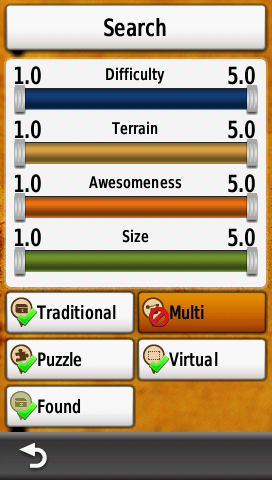
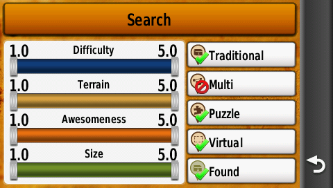
Using any of the 11
available Geocache Type filters results in all geocaches of types
'Geocache', 'Project APE Cache', 'Locationless (Reverse) Cache',
'Geocache Course (Maze Exhibit)', 'Giga-Event', 'Other Cache', and
'Lab-Cache' also being disabled. Restoring any Geocache Type filter only
returns geocaches of like type to the map and list, while previously
listed geocache types remain permanently hidden, leaving the user with
no method to restore them. [22FEB19] [3.40...3.50]
The [Menu] button and associated 'Low Light' + 'Standard Light' modes are
missing from the Camera page after updating device firmware to version
3.40. [example] [wiki]
(29) [18MAR19] [3.40...3.50]
Adventures may randomly lose data and/or disappear from the device, and
the user may find Adventure data files moved and/or deleted between
microSD card and internal memory. [18DEC20] [3.50]
With Current Track configured for 'During
Activity' and Activity Recording paused or inactive, the Current Track
Activity Plot Tab accumulates 'Total Ascent' data while the Information Tab
continues to display no change for the same value. [29MAR21] [3.50]
Keyboard language selection is not retained across power cycles. [31MAY21] [3.50]
Montana 600/650
-
When connecting the Montana to a PC via USB the GPSr asks 'Enter Mass Storage Mode?' (Spanner Enabled). After selecting "Yes", the unit does the opposite and enters GPS mode, requiring the user to unplug the USB cable and repeat the scenario. A second attempt is usually, but not always successful. [example] [11NOV11] [4.20...5.40]Montana ignores profile preferences for which maps are enabled/disabled. User can adjust settings as desired, switch profiles, return to original profile, and find map preferences not retained. [11NOV11] [4.03] [Resolved 4.10] [01DEC12] [Returned 4.60...4.70]When using shortcuts to enable/disable maps, the settings do not take effect. [11NOV11] [4.01...4.10] [Resolved 4.20]In the Map Screen, entering [Settings] [Map Selection] and enabling/disabling maps, and returning to the Map Screen, map selection changes do not take effect until the user Zooms in/out one level. [11NOV11] [Resolved 4.01]When switching between profiles, the wallpaper behind the dashboard does not refresh properly with the rest of the screen. [11NOV11] [Resolved]If a user makes changes to a GPX file on the Montana, and saves it without changing the file name, the Montana will not properly index the GPX file on next boot. Resulting behavior is 'Missing GPX Files' and 'Freezing' or 'Crashing' when attempting to read a GPX file that is no longer properly indexed. Currently, this issue can be avoided by first removing th GPX file, rebooting without it, then writing the new GPX file, and rebooting again. This behavior is also reported on 62s and 78s models. [groundspeak] [11NOV11] [4.20...6.10]Navigating (Track Up) while mounted in the automotive cradle, Montana reports direction of travel correctly, but when stopped the unit seems to have trouble maintaining correct bearing, and the map screen will rotate in random directions until travel resumes. [11NOV11] [4.01...5.40]OpenCaching.com not able to send geocaches to my Montana using Communicator 4.0.1 [22JAN12] [Resolved]Montana not correctly rendering POI icons from POI files that render properly on Oregon and Dakota. [example] [wiki] [garmin.de] [22JAN12] [4.02...4.60]Using the [Profile Change] application to switch profiles, the newly selected profile will open in the page selected as "Start Page" in the Profile Menu Setup. Using [Shortcut] to switch profiles, the newly selected profile will open in the same page as the shortcut was placed in the previous profile, not the page selected as "Start Page" in the Profile Menu Setup. [22JAN12] [Resolved 4.01]Calendar application does not accurately log all events. Many "Found Geocaches" are not displayed or listed [26JAN12] [Resolved 3.94]GPSr position is 'sticky'. This issue occurs randomly during slow movement/walking. Issue is present with all newer Garmin GPSr units. The position arrow on the map will stop moving suddenly, and remain at a fixed location while you continue to move away. The GPSr coordinates do not update, and appear frozen or stuck. [example] [RANDOM] [30JAN12] [3.80...4.01] [Improved 4.10]When attempting to log a geocache, menu selections link to incorrect sub-menu's. Montana Menu Selection behavior confusing and dysfunctional. [example] [RANDOM] [02FEB12] [Resolved]Unable to receive wireless data transfers from other Garmin ANT+ equipped devices. Each attempt results in "Wireless Connection Lost. Attempting to Reconnect." and "Searching...". [wiki] [gpsfd] [groundspeak] [example] [18FEB12] [3.90...5.40]Unable to send wireless data transfers to other Garmin ANT+ equipped devices. Occasionally, one transfer will complete before the wireless sharing feature ceases to function. All further attempts fail until rebooting device. [wiki] [gpsfd] [groundspeak] [3.90...5.40]Montana deletes user created waypoints from internal memory after the current track is saved. [example] [20FEB12] [3.90] [Resolved 4.01]Unfavorable nüvi Dashboard behavior (compared to nüvi 3790 with identical maps loaded): [wiki] [20FEB12] [CityNav NA NT 2012.40, 2013.10, 2013.20, 2013.30] [3.90...4.60]- Montana intermittently displays incorrect Lane Assist turn arrows. [example]
- Intermittently, Lane Assist information may appear only briefly, then disappear.
- Montana intermittently fails to display Speed Limit data (displayed at a given location one time, but not the next).
- 'Distance to Next Turn' intermittently hangs or freezes well beyond the next maneuver.
- Route calculation algorithms are random and inefficient. [example]
When navigating waypoint information menus from the map screen, the menu items loose original text and become garbled or blank, and randomly indicate incorrect links (Indicates 'Area', but takes you to 'Depth', etc.) [example] [16MAR12] [3.96] [Resolved 3.97]Selecting [Waypoint Manager], selecting any waypoint listed, [View Map], [Waypoint Information], and [Back] results in waypoint displayed name becoming garbled. [example] [17MAR12] [3.96] [Resolved 3.97]In Map application, select a geocache, selecting and view [Geocache Information], return to map view, and geocache title is missing and/or garbled in [Geocache Information]. [example] [17MAR12] [3.96] [Resolved 3.97]After creating a shortcut to alter routing method, that shortcut must be activated twice before the active routing method is updated to reflect the setting in the shortcut. If the shortcut routing method is the same as the current routing method, no recalculation occurs. [29MAR12] [3.70...5.00]In MAP application with dashboard active, selecting a position on the map removes dashboard to display Info Box, and selecting "X" clears Info Box, but active dashboard does not return (Should It?), nor does small chevron to slide dashboard back into Map View. Selecting Back arrow will bring Dashboard back. [14MAY12] [4.03] [4.10...4.60] [Garmin Response: "Dashboards Are Never Available While Panning The Map"]While viewing the Calendar during a local sunrise or sunset, and the color scheme changes from day to night view or night to day view, only the currently selected calendar day remains visible, and all others are washed out until user exits and reenters the Calendar. [Sunrise] [Sunset] [14MAY12] [4.03] [Resolved 4.20]If user changes [Setup | Routing | Activity] with [Setup | Routing | Route Calculation Method | Prompted] enabled, the menu will reflect the newly selected activity while the Montana continues to use the prior activity for route calculation. This behavior continues after changing profiles, power cycling, or hard resetting the Montana. [wiki] [wiki] [14MAY12] [4.03...5.40]- Example 1: [Resolved 4.70]
- [Setup | Routing | Activity | Automobile Driving]
- [Setup | Routing | Route Calculation Method | Prompted]
- [Setup | Routing | Activity | Direct Routing]
- [Where To?] (Any Destination) [Go]
- [Map] screen appears with a Direct Route calculated
- [Where To?] [Stop Navigation]
- [Setup | Routing | Activity | Automobile Driving]
- [Where To?] (Any Destination) [Go]
- Select [Minimize Distance] or [Minimize Time] or [Minimize Ascent]
- [Map] screen appears with a Direct (or other non Automobile Driving Activity) Route calculated
- Example 2:
- Select Profile 'A' via [Profile Change]
- [Setup | Routing | Activity | Automobile Driving]
- [Setup | Routing | Route Calculation Method | Prompted]
- Select Profile 'B' via [Profile Change]
- [Setup | Routing | Activity | Direct Routing]
- [Where To?] (Any Destination) [Go]
- [Map] screen appears with a Direct Route calculated
- [Where To?] [Stop Navigation]
- Select Profile 'A' via [Profile Change]
- [Where To?] (Any Destination) [Go]
- Select [Minimize Distance] or [Minimize Time] or [Minimize Ascent]
- [Map] screen appears with a Direct Route calculated
When switching between profiles sharing identical [Setup | Routing | Activity] but different [Setup | Routing | Avoidance Setup] settings, the active route is not recalculated to reflect the change. [wiki] [15MAY12] [4.03...5.30]WAAS/EGNOS functions intermittently, or not at all, while some WAAS/EGNOS satellite positions are reported incorrectly. [20MAY12] [4.03...5.30]Track Distance is not properly reset when using shortcuts to clear current track and reset trip data. [wiki] [4.10] [13JUN12] [Resolved 4.20] [Renewed 4.60] [Resolved 5.00]
After clearing Trip Computer Data and Current Track Log, and going for a walk, Trip Computer and Track Log do not agree [example v4.10] [example v4.70], displaying incorrect and inaccurate information. [wiki] [groundspeak] [groundspeak] [13JUN12] [4.10...4.90] [Resolved 5.00]
Selecting [Where To? | Waypoints | Enter name for search] and entering a single letter or number sometimes results in a displayed waypoint list beginning with an entirely different character. For example, entering "S" returns a list of waypoints beginning with the letter "M" or entering "U" results with a returned waypoint list beginning with "H". [15JUN12] [4.20...4.70]Incorrect heading information is attributed to photos taken with camera on x50 models. [30JUN12] [4.20] [4.70] [Resolved 4.80]Profiles become corrupted after changing order (manually or after deleting other profiles) in Profile List [wiki] [10JUL12] [4.20...5.20] [Resolved 5.40]Unable to [Delete] or [Make Favorite] any [Archived Tracks] within [Track Manager]. [wiki] [4.40...4.50] [06SEP12] [Resolved 4.60]Selecting [Waypoint Manager] and choosing any waypoint will result in [Location] displaying only the 'N' coordinate. [wiki] [10SEP12] [4.50] [Resolved 4.60]Shortcuts that do not exit the Main Menu remain highlighted once selected. Multiple shortcuts can remain highlighted simultaneously. [groundspeak] [12SEP12] [4.40...4.60] [Resolved 5.00]Dashboards are no longer transparent in Landscape View with Orientation set to Automotive Mode. [groundspeak] [20SEP12] [Garmin Response: "This feature is behaving as expected, and has not been changed."] [4.60]After changing any track visibility from [Show On Map] to [Hide On Map] in [Track Manager] and power cycling the Montana, the setting is lost/forgotten and the hidden tracks again appear visible on the map. [wiki] [01OCT12] [4.60...4.70] [Resolved 4.80]Entering the nüvi Profile via a shortcut placed in the Favorite Dashboard results in unfavorable behavior. The Favorite Dashboard may randomly flash over the nüvi Profile and/or may appear partially and garbled. [wiki] [example] [01OCT12] [4.60...4.70]After using a shortcut to change [Setup | Display | Orientation Lock] and power cycling the Montana, the screen orientation is locked to the last setting, and [Setup | Display | Orientation Lock] shortcuts no longer function. Manually changing screen orientation in the setup menu is still possible. Exiting and re-entering the current profile will restore [Setup | Display | Orientation Lock] shortcut functions. [adv] [01OCT12] [4.60...4.70]When switching between profiles with the Favorites Dashboard active in the Map application, the Favorites Dashboard is not immediately updated with the unique settings for the currently active profile, requiring the user to exit and re-start the Map application before the Favorites Dashboard is properly updated. [wiki] [01OCT12] [4.60...4.70]Adventures are randomly deleted from Montana memory, one at a time, with each power cycle. [garmin] [05OCT12] [4.60]Starting the [Adventures] application and selecting any [Adventure], [Adventure Title Bar], [Content], [Waypoints], any [Waypoint], [Waypoint Title Bar] {Icon Event Occurs}, [Back], and [Back] exits the Adventure application and displays a short list of random, unrelated waypoints. Replaced with [Exit], [Back] is no longer available, and the [Adventures] application must be restarted. {Icon Event} = The current Adventure Icon briefly appears over the [Waypoint Title Bar] when selected. [06OCT12] [4.60]Starting the [Adventures] application and selecting any [Adventure], [Adventure Title Bar], [Content], [Tracks], any [Track], [Track Title Bar] {Icon Event Occurs}, and [Back] skips to the Adventure Overview Page, opposed to returning to the Track List Page. {Icon Event} = The current Adventure Icon briefly appears over the [Track Title Bar] when selected. [06OCT12] [4.60]Starting the [Adventures] application and selecting any [Adventure], [Adventure Title Bar], [Content], [Photos], any [Photo], [Photo Title Bar] {Icon Event Occurs}, and [Back] skips to Adventure Overview Page, opposed to returning to the Photo List Page. Selecting [Back] again displays a text-only list of available Adventures, opposed to the standard graphic Adventures Selection Menu. {Icon Event} = The current Adventure Icon briefly appears over the [Photo Title Bar] when selected. [06OCT12] [4.60]When starting the [Adventures] application and selecting any [Adventure] then [Adventure Title Bar] to view the Adventure description, if the description is not longer than one full screen, the user is unable to scroll the text to reveal information hidden under the [Content] and [Start] buttons. [example] [07OCT12] [4.60]When charging the Montana while powered off, the display sometimes becomes scrambled. [example] [wiki] [10OCT12] [4.60] [Resolved 4.70]When filtering waypoints in [Waypoint Manager] by symbol and selecting [Delete All (xx)], ALL waypoints are deleted from the Montana, regardless of symbol group selected. [wiki] [garmin.de] [11OCT12] [4.50...4.90] [Resolved 5.00]Speed limit information is not displayed while navigating routes created in BaseCamp using the nüvi dashboard. [garmin] [01NOV12] [4.60][Current Profile] [Setup | Routing | {Current Routing Activity} | Off Route Recalculation Method | Off] is ignored while navigating a BaseCamp created route after navigating a non-BaseCamp created route using a different routing activity (regardless of profile), when [Current Profile] [Setup | Routing | {Previous Routing Activity} | Off Route Recalculation Method | Automatic (or) Prompted]. [03NOV12] [4.20...5.40]Intermittently, the Map application incorrectly shows the current position in the Atlantic Ocean while the Satellite Dashboard and/or Satellite Application continue to display the users correct position while indicating strong satellite signal reception. This behavior may require a Hard Reset to correct, or the erroneous position reporting may self resolve. Track Log recordings reveal the erroneous position as S0.00000 W0.00000. [wiki] [18NOV12] [4.10...4.60]After disabling the GPS radio and setting a new location on the map (GPS Simulation Mode), the Status Dashboard and Satellite Application continue to display the last known location (when GPS radio disabled), as opposed to the simulated location otherwise correctly reported. [wiki] [example] [26NOV12] [4.60...5.40]Selecting an Adventure, then [Content] [Photos] {photo} [Title Bar] displays photo location, camera information, and a small photo thumbnail, but with no option to view the photo full screen. The photo displayed in this [example] is stored on the Montana at a much higher resolution of 800x1200 pixels, as are most other Adventure photos. Please include functions to select and view photos in full screen, with zoom and pan capabilities. [01DEC12] [4.60]While viewing photo information within Adventures application, camera information is incomplete, incorrectly wrapped, and improperly appended with distance to photo location. [example] [01DEC12] [4.60...7.60]Selecting an Adventure, then [Content] and [Start] opens the Map application with your current location displayed, and nothing more. Nothing is actually started. [01DEC12] [4.60...7.60]Once an Adventure is [Started], the only option available is to [Stop Adventure], which results in the Adventure being shown as 'Finished' or 'Complete'. Please update with [Exit Adventure] (leave Adventure without marking as finished) and [Complete Adventure] (rate Adventure and mark as finished). [01DEC12] [4.60...7.60]Intermittently, the Power Button Single Click refuses to open the Status page, while Double Click options continue to function properly, regardless of the Profile selected and/or powered mount in use (or not). This behavior can only be resolved by re-booting the Montana. [06DEC12] [4.60]After changing [Setup | Appearance | Landscape Controls] from Right to Left, Map Zoom controls correctly move to the left side of the screen, except when using the nüvi Dashboard, which is counter to expectation. [wiki] [06DEC12] [4.60...7.60]Montana randomly exhibits an 'Infinite Loop Route Calculation' behavior and may freeze and/or crash as a result. [wiki] [20DEC12] [4.60]
Improperly placed a Feature Request under Bugs. Moved to
Feature Request #85
Improperly placed a Feature Request under Bugs. Moved to
Feature Request #86Montana search engine bottlenecks after selecting [Where To? | {any category}] with City Navigator and any Garmin Topo 2008 map installed. Individual search results can take several minutes, instead of seconds. [gpsreview] [01JAN13] [4.60]Using either [Track Manager | Clear Current Track] or [Trip Computer | Reset | Clear Current Track] will clear the \Garmin\GPX\Current\Current.gpx Track Log Recording, but only [Trip Computer | Reset | Clear Current Track] will clear the Track Distance data field. [wiki] [05FEB13] [4.60...4.90] [Resolved 5.00]Text displays incorrectly for geocaches with longer titles. [example] [09MAR13] [4.80]
[Resolved 4.90]
Nuvi and Automotive Dashboard do not properly display 'Automotive Turn' info, left data field in Nuvi Dashboard improperly displays 'Distance to Next' (not a valid option). [example] [15APR13] [4.90...5.60]
[Resolved 5.70]Montana randomly displays "Acquiring Satellites" during normal use, while nearby GPSr units display no signal loss. Satellite signals may return within minutes, or may require cycling the power to restore proper operation. [adv] [adv] [adv] [adv] [wiki] [example] [20MAY13] [4.90...5.30]After Selecting [Where To?] [Cities] [Alpha Search] and selecting [X] to exit (without entering a search term), the Montana either (A) fails to retain the previous data sort, listing all loaded cities alpha-numerically, or (B) displays an empty list of cities with a perpetually running progress indicator. [16JUL13] [5.20...7.60]Montana
6x0 will not properly eject from Win7/Win8 when connected via USB 3 port. [01AUG13] [5.20]
All icons below the VIRB icon in the
shortcut icon selection menu have been shifted by one position.[21AUG13] [5.30]Selecting [{Any Adventure} > Content > Photos] may fail to display loaded photos for the selected Adventure. [wiki] [02OCT13] [5.40] [See
wiki for resolution]Performing a Master Reset or Soft Reset results in the active profile being written over by the Recreational profile. [adv] [09OCT13] [5.40]
Waypoints, Tracks, Photos (etc.) saved between 12:00pm and 12:59pm with [Setup | Time | Time Format | 12 Hour] selected are improperly time stamped as 12:xxam (should be saved as 12:xxpm). [06NOV13] [5.40...7.00] [Resolved 7.10]
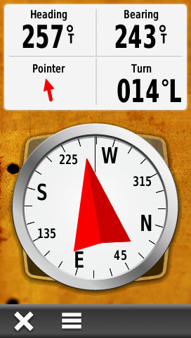
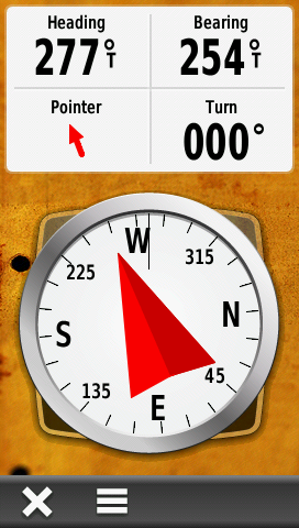
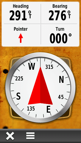
Waypoints, Tracks, Photos (etc.) saved between 12:00am and 12:59am with [Setup | Time | Time Format | 12 Hour] selected are improperly time stamped as 00:xx (should be saved as 12:xxam). [06NOV13] [5.40]Map authentication process introduced with firmware v5.60 may disable legitimately purchased maps. [01FEB14] [5.60] [Resolved 5.70]Shaded relief is not displayed when [Setup | Map | Advanced Setup | Shaded Relief | Show If Available] and [Setup | Appearance | Mode | Night] are selected. [Night and Day] [wiki] [13JUN14] [5.90]Intermittently, the 'Turn' data field, 'Pointer' data field, and 'Compass Bearing Indicator' may fail together or independently of each other. [All OK] [Turn Fail] [All Fail] [wiki] [13JUN14] [5.90]When using [Geocaching | Quick Filter] in Portrait Mode with [Setup | Geocaching | Geocache Style | OpenCaching.com] enabled, the Geocache Type selections do not properly toggle when selected. This behavior is not present in Landscape Mode. [example] [wiki] [13JUN14] [5.90] [Resolved 6.10]When using [Geocaching | Quick Filter] in Landscape Mode with [Setup | Geocaching | Geocache Style | OpenCaching.com] enabled, the 'Search' button fails to activate the search function. This behavior is not present in Portrait Mode. [example] [wiki] [13JUN14] [5.90] [Resolved 6.10]Selecting [Where To? | Change Route Activity] with [Setup | Routing | Activity | Prompted] and [Setup | Routing | Calculation Method | Prompted] enabled, the user is not prompted for new 'Calculation Method' preference as expected (user is prompted for both 'Activity' and 'Calculation Method' preferences during initial destination selection). [wiki] [13JUN14] [5.90]
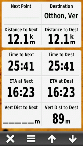
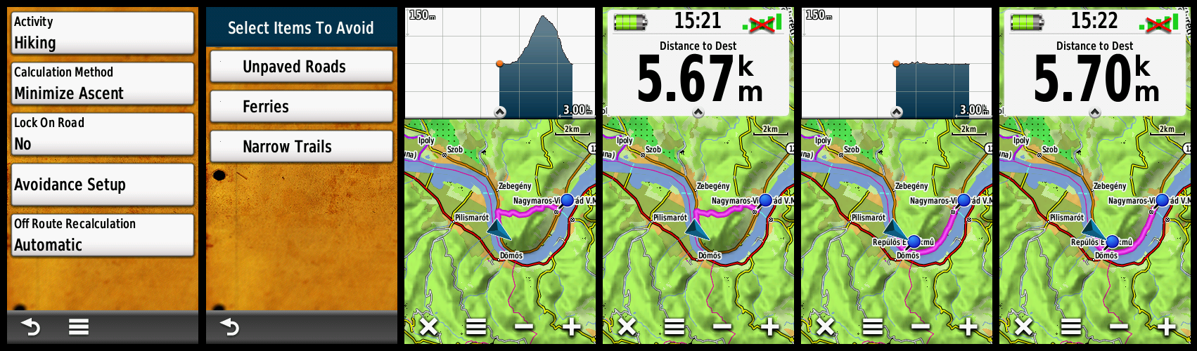
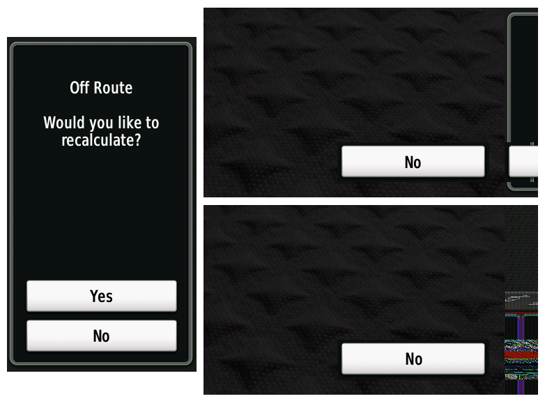
While navigating the last segment of a route or when the next point is the same as the destination point, the 'Waypoint at Next' and 'Vertical Distance to Next' data fields are left blank while 'Distance to Next', 'Time to Next', and 'ETA at Next' are populated. [example] [wiki] [13JUN14] [5.90]Montana fails to accurately calculate routes when calculation method 'Minimize Ascent' is selected. [example] [wiki] [13JUN14] [5.90]Montana fails to properly display Off Route Recalculation Prompt while in Landscape orientation. [example] [wiki] [18OCT14] [6.20]
Selecting [Setup > Main Menu] and adding a new Main Menu Page results in all
existing Main Menu Page Dashboards being shifted by one page. [example]
[30DEC18] [7.50...7.60]
Removing all Main Menu Pages to the left and right of the Main Menu Start
Page in [Setup > Main Menu]
and exiting [Setup] will result in all Main Menu Page icons being hidden.
Exiting and re-entering the current profile restores the Main Menu Start
Page icons. [30DEC18] [7.50...7.60]
Using any of the 11 available
Geocache Type filters results in all geocaches of types 'Geocache', 'Project
APE Cache', 'Locationless (Reverse) Cache', 'Geocache Course (Maze
Exhibit)', 'Giga-Event', 'Other Cache', and 'Lab-Cache' also being disabled.
Restoring any Geocache Type filter only returns geocaches of like type to
the map and list, while previously listed geocache types remain permanently
hidden, leaving the user with no method to restore them. [22FEB19] [7.60]
Keyboard language selection is not retained across power cycles. [31MAY21] [7.60]
Crash Reports
Montana 610/680
-
When navigating to the 'second' 'next stage' of a
multi-cache after having just 'found' a multi-cache with multiple stages,
the GPSr will freeze and/or crash. [groundspeak]
[26FEB19]
(33) [3.40...3.50]
Montana 600/650
-
Montana fails to properly index updated GPX files and crashes when attempting to read GPX file. [See Bug #6] [25FEB12]When selecting [Geocache] [Show Description] Montana will freeze or power down. [See Bug #6] [25FEB12]
After selecting [Save Current Track], while 'Exporting Track', Montana hangs/freezes at 100%, requiring removal of batteries to restart the unit. After rebooting, the track being saved is not present, and several unrelated saved waypoints have been deleted from memory. [Resolved 4.01]Montana will not complete boot process when images with an undisclosed issue are loaded in the GeocachingPhotos directory. Requires Hard Reset and fresh firmware install to correct, and GeocachingPhotos function introduced in firmware 3.80 remains functional only with OpenCaching.com loaded photos with this bug. [Resolved 3.94]While in Automotive Cradle, and external power is removed (Ignition switched off, etc.), Montana prompts with "External Power Lost. Continue on Battery Power?" with two options: "Turn Off" or "Stay On". When selecting "Stay On", the Montana either shuts down or crashes every time! [example] [3.94] [Resolved 3.98]Changing Map Detail settings while viewing any waypoint within Waypoint Manager application crashes unit [example] [3.96] [Resolved 3.97]Enabling or Disabling maps while viewing any waypoint within Waypoint Manager application crashes unit [example] [example] [3.96] [Resolved 3.97]After reviewing information received from a Garmin chirp™ wireless beacon and selecting [Go], the Montana crashes. [3.96] [Resolved 3.97][Setup] [Main Menu] [Select] [Setup Drawer] crashes unit [4.02] [Resolved 4.03][Waypoint Manager] [Select Symbol] [Select waypoint from list] [Find Near Here] [Food and Drink] [All Categories] [Select Keyboard Entry] Crashes Unit [4.03] [Resolved 4.10]Enter [Track Manager] and select any track from list. Select [View Map] and click any random position on the screen. Select the information bar when it appears at the top of the screen, then select the [Flag] icon to create a new waypoint. Select [OK] and then select the [Pencil] icon to edit the newly created waypoint. Select [Waypoint Name] and the Montana crashes. [4.03] [Resolved 4.10]Select [Waypoint Manager], sort alphabetical, select [Symbol] and choose restaurant symbol. Scroll down the list presented and you will find waypoints with no/garbled names. Select any of these and the Montana Crashes. [wiki] [15JUN12] [4.20...4.70]Creating multiple shortcuts in succession results in a crash and recently created shortcuts are incomplete or missing [08JUL12] [4.20]Intermittently, after selecting [Yes] to enter USB Mass Storage Mode, the Montana will immediately shut down, requiring the user to disconnect and reconnect the USB cable to make additional attempts to enter Mass Storage Mode. [23JUL12] [4.20]Selecting the [Setup Menu] button from within the [Map Application] with a Data Field (Small or Large) Dashboard enabled results in a crash [30AUG12] [4.30...4.40] [Resolved 4.50]With the Favorites Dashboard active, selecting [Menu] [Change Favorites] [Add Favorite] and adding any [Application], [Shortcut], [Setup] or [Where To?] and exiting the menu will crash the Montana. [01OCT12] [4.60]Selecting [Track Manager] [Archived Tracks] [{any track}] [Elevation Plot] [{select any position on the graph}] [Menu] [View Map] [Menu] [Setup Map] [Select Map] always results in a crash. [adv] [13MAY13] [4.90]Opening the Elevation Plot application while navigating an active route results in a crash. [wiki] [10JUN13] [5.00...5.30] [Resolved 5.40]
Hardware Failures
Montana 610/680
Montana 600/650
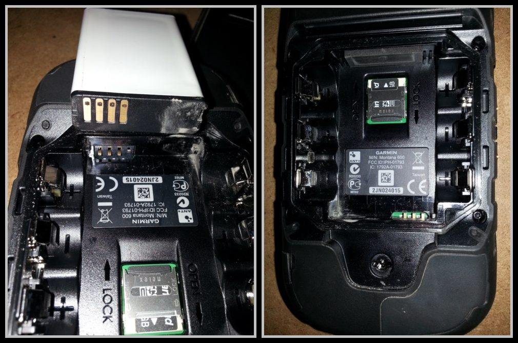
- Montana may permanently stop receiving satellite signals when used in rugged environments due to ceramic antenna separation from circuit board. [adv] [09JUN12]
- Using the 'Rugged' Montana in direct sunlight renders the touchscreen dysfunctional resulting in:
- 1. Self selecting menu options
- 2. Map screen self selects and sticks in manual scroll mode
- 3. Touchscreen responds erratically to input rendering Montana useless
[example] [example] [adv] [08JUL12] - Montana
Li-ion battery contacts may disintegrate over time when used in environments prone to prolonged vibration, resulting in the GPSr shutting down when removed from (or when power is removed from) a powered mount. [example] [adv] [15JUL13]
-
Early production units exhibit a high frequency of touchscreen failures. Defective touchscreens may be visually identified by a wafer pattern that is visible when viewing the screen at a 45° angle with the unit powered off. [groundspeak] [gpsreview] [06AUG11]
- Montana
external housing may crack and/or tear near or around the power button,
compromising IPX7 protection and leaving internal components exposed to the
elements. [example] [05OCT20]
Missing Features
Montana 610/680
- Geocaching with Photos found on previous Garmin Montana 600/650 and other Garmin GPSr series not currently supported. [27JAN16]
- Advanced Geocaching User Interface available on other Garmin GPSr not currently supported by Montana. [27JAN16]
- Montana 610/680 users can not enable/disable
Custom Maps (KMZ) individually like they can on many similar Garmin GPSr.
[14JAN21]
Montana 600/650
- With other popular Garmin GPSr units (Oregon, Dakota, etc.), while using the map application, the user was able to switch between 'North Up' and 'Track Up' by tapping on the north arrow. [25FEB12] [Resolved 3.96]
- Security Lock: Add PIN Code with location support. [04MAY12]
-
Include Wherigo software present on older Garmin GPSr units. [13MAY12] [Where is Wherigo?]
- Previous Garmin GPSr rendered an Estimated Positional Error (EPE) circle around the map position icon (vehicle). Please include an option to enable/disable this feature. [19MAY12]
- Ability to measure distance(s) live on the Map Screen between multiple points without creating waypoints is present on the Garmin GPSMap 62. [19MAY12]
- Include function to delete all waypoints by symbol, similar to GPSMap 60 series. [09JUN12] [Resolved 4.30]
- Add support for shaping points [garmin] [16JUL12]
-
Include an "Along Current Route" function to display waypoints and POI's within a user adjusted radius of the current route, similar to StreetPilot 2610. [wiki] [See Feature Request #19] [30JUL12]
- Include option menu to enable/disable imagery in BlueChart Vision Maps, as described here. [29AUG12]
- Add Custom Avoidance settings in Routing Options, similar to GPSMap 276c [wiki] [18OCT12]
- When not navigating a route with the 60CSx or 276c, Guidance Text would indicate the upcoming crossroads/exit, a very useful feature. Regardless of Dashboard selected on the Montana, Guidance Text only indicates the road currently being traveled, not very useful. Please restore this feature to Guidance Text the Montana. [wiki] [10DEC12]
- Selecting [Setup | Main Menu | Add Item Here | Where To?] ONLY allows access to top level POI categories. Please make POI sub-categories available. For example, a user can choose 'Auto Service', but not 'Parking' or 'Rest Area', etc. [wiki] [24DEC12]
- Add capability to enable/disable 24K Topo Contour Lines, as with GPSMap 276c. [wiki] [27DEC12]
- Please include [Precharged NiMH] option in [Setup | System | AA Battery Type] similar to Oregon
6x0 [28AUG13]
- Please include 'Current State' and 'Complete Database' options when searching for a City. [wiki] [21OCT13]
Requested Features
Montana 610/680
- Please add
Garmin inReach Mini access via ANT+ connection [05MAY19]
-
Please introduce a simple notepad
page that allows the user to create, edit and save geo-tagged alpha-numeric
notes for future reference. [Gr]
[17OCT19]
Montana 600/650
- When creating a shortcut, add an option to change the coordinate system being used. [25FEB12]
- When creating a shortcut, add an option to disable all maps. [25FEB12]
- When creating a shortcut, add an option to select the default zoom level for the map screen. [25FEB12]
- Under [Profiles] [Mount Profiles] add an option to run a shortcut. [25FEB12]
- In [Profiles] [Mount Profiles] add a mount option for [When Connected to Host Computer]. [25FEB12]
- Add the ability to send GPX files to the Montana from other ANT+ enabled devices in the field. [25FEB12]
- [Geocaching] [Find a Geocache] [Select Geocache] displays the geocache location on the map. While navigating to a geocache, if the [Geocaching] Menu is selected, no option is given to [View Map]. Please add this function allowing the user to inspect the map area around the geocache destination at will. [25FEB12]
- [Geocaching] [Find a Geocache] [Select Geocache] [Go] begins navigation to desired geocache location from current location. A user may wish to first navigate to an additional waypoint (Parking, Trail Head). Please include the [Navigate Via Waypoint] function in [Geocaching] to allow the user to select a beginning waypoint. Upon arrival of selected waypoint, the Montana will automatically update the destination to the geocache originally selected. [25FEB12]
- [Geocaching] [Find a Geocache] Please add small icons in each cache selection button indicating the results of the last five logs: [Yellow Dot = Found It!] [Blue Dot = DNF] [Blue Cross = Needs Maintenance] [Green Cross = Owner Maintenance] [Red "X" = Disabled] [Green "X" = Enabled] [White/Grey Square = User Note]. [25FEB12]
- Please update firmware to recognize a 'protected directory' (perhaps named 'ROM' or 'GPX2') on both the Montana and installed uSD card. Users could use the ROM directory to store important maps, icons, GPX files, etc. without worry the GPSr may accidentally delete them, as the GPSr would be granted READ ONLY privileges. [25FEB12]
- Include a new "Notepad" application allowing users to record/access personal notes about waypoints, POI's, geocaches, etc. Notes would be geotagged with device location (Editable) and searched by Name, Locations, etc. [26FEB12]
- Please create a new Dashboard that combines the Compass and two Small Data Fields, similar to this example. [20MAR12]
- Add a function to enable/disable geocache gpx showing on the map - [Setup] [Geocaching] [Show/Hide] [15APR12]
- Add option to sort waypoint, track, and route list displays alphanumerically. [04MAY12]
- Create new 'Four Corner Dashboard' that places four user configurable transparent data fields, one in each corner of display. (Similar to ZUMO 660 and GPSMAP 478) [04MAY12]
- Track Manager: Please add options to [Show All Tracks], [Hide All Tracks], and [Delete All Tracks]. [adv] [04MAY12]
- Waypoints: Add support for Waypoint Categories [Favorites, etc.] and Waypoint contact information fields (Name, Address, Phone Number, etc). [04MAY12]
- Make [Screen Capture] setting 'sticky' in each profile. [04MAY12]
-
[Where To?]: Add option to [Search Along Active Route] and include search radius setting. [See Missing Feature #8] [04MAY12]
- Power Management: Add profile specific option to keep unit powered on (without user input) when external power is lost. [04MAY12]
- Trip Odometer: Add multiple Trip Odometers with ability to use and reset them individually. [04MAY12]
- [TracBack]: Add one touch shortcut to enable this function. [04MAY12]
- Make Camera Settings profile specific. [04MAY12]
- Add [Clear Current Track] option to [Setup | Shortcuts | Tracks] [04MAY12]
- [Track] [Show On Map/Hide On Map]: Save this setting with track GPX file similar to how track color is saved in GPX. [04MAY12]
- Setup - Shortcuts: Devise method to indicate which functions/options are applied to currently displayed shortcut. [04MAY12]
- Add shortcut to reset Current Odometer without resetting all saved data. [04MAY12]
- Add Data Field to display Power Source Voltage (Li-ion, AA, USB, External Mount). [04MAY12]
- [Setup]: Devise method to indicate which options are Global and which are Profile Dependent. [04MAY12]
- Add option to have a "Muted/Not Muted" icon visible when external speaker is present. [04MAY12]
- After sending multiple routes with shared waypoints from BaseCamp to Montana, the shared waypoints are listed multiple times in Waypoint Index. Please add function to Montana to compare and display identical waypoints only once in Waypoint Lists. [06MAY12] [Resolved 4.20]
- Add option to enable/disable a user selectable warning/notification tone to be emitted before each spoken direction during guided navigation to help prevent user missing part of spoken directions while operating in noisy environments. [07MAY12]
- Add multiple attribute fields to waypoints. [08MAY12]
- Make compass heading available when viewing geotagged photo information. [wiki] [08MAY12]
- [Setup | Routing | Route Transitions] options currently include Auto, Manual, and Distance. Please add a Time function to this list, with 10, 20, 30, 45, 60 and 120 second options, creating speed dependent routing directions that consider the users current velocity and distance to the next turn, etc. [10MAY12]
- Add Setting to allow user to choose keyboard layout in Landscape and Portrait modes. [13MAY12]
- Add function to [Sight 'N Go] application to manually enter direction of projected waypoint in degrees. [23MAY12]
- Disable Screen Lock while applications that are started via Power Button Double Tap are open. [28MAY12]
- When using the Red Pin to select a map point in the Map Application, an Information Bar appears with location information, distance to location, and compass direction to location. Selecting the Information Bar opens a Waypoint Information Page with the same basic information. Please include the "Elevation Delta" (when DEM information is available) in both the Information Bar and Waypoint Information Page using "+" and "-" operators to indicate elevation gain or elevation drop, respectively. [28MAY12]
- When using Geocaching Nearest Dashboard, tapping the dashboard brings up the standard Geocaching Menu. Please add an option to enable immediate navigation to the geocache displayed in the Geocaching Nearest Dashboard [28MAY12]
- Currently, in [Setup] [Display] [Orientation Lock], [Lock Portrait] always places the 'Garmin' text at the bottom, and [Lock Landscape] always places the 'Montana
6x0' text at the top left. Please add settings for [Lock Landscape Left] (Current function) and [Lock Landscape Right] (placing the 'Montana
6x0' text at the bottom right). [29MAY12]
- Add a Camera setting to enable/disable an audible shutter confirmation. [29MAY12]
- Include Setup option to select a vehicle (map position icon) for each activity type, and keep these settings profile dependent. [03JUN12]
- Add a Compact Dashboard with only two small data fields visible [05JUN12]
- Add a function to enable the Stop Watch application to count a lap every [distance set by the user], similar to GPSMAP 60 and Edge [07JUN12]
- Improvements and/or changes are needed to [Where To?] in Simulation Mode as outlined in this [wiki ] [08JUN12]
- Add File Manager Application to enable user to view/select folders/files and enable/disable individual folders followed by an automated re-indexing of all files in enabled directories. A user may browse a 'UserSort' directory, the Montana displays all sub-directories, user can select each directory to view file list for that directory, and enable/disable each directory much like the Map Selection menu, followed by an automated reboot and re-indexing of all enabled folders/files. This function should be available for Montana and uSD card directories. [08JUN12]
-
Add [Archive Track] [Save Current Track] [Save Current Track Portion] options to [Shortcuts | Setup | Tracks] [12JUN12]
- Add [Recalculate] function in [Setup | Routing] and make this function available in shortcut creation menu. [26JUN12]
- Make [Setup | Tracks | Color] function available in shortcut menu. [30JUN12]
- Record [Setup | Routing | Activity] type(s) as part of saved tracklog *.gpx files. [30JUN12]
- Implement Advanced Track Log functions [wiki] [groundspeak] [30JUN12]
- Add function to avoid any portion of active route by selecting "X" (add to each step in route list) from the route list view, triggering an automatic recalculation for that portion of the active route. [wiki] [08JUL12]
- Update firmware to check the \Garmin\CustomSymbols\ directory for any <Groundspeak:type> element in each gpx file before assigning a generic symbol. [09AUG12]
- Enable option to adjust zoom level for User Waypoints and Custom POI's independently. [adv] [25AUG12]
-
Add option [At Power On] to [Setup | Tracks | Auto Archive] [wiki]
[wiki]
[groundspeak]
[groundspeak] [05SEP12]
- Add Profile Setting to delay "External Power Lost" warning for '30 seconds', 'One minute', 'Five minutes', 'Ten minutes', and 'Fifteen minutes', or 'xx minutes' where 'xx' = user selected. [09SEP12]
- Update Geocaching Dashboard Compass behavior to always (or make selectable) point towards Destination Waypoint while actively navigating (for guidance to next stage, or parking, or trail head, etc.). [wiki] [11SEP12]
- When selecting [Geocaching] [Find Next] allow user the option to enter [Coordinates] or select existing [Waypoint]. [wiki] [13SEP12]
- When using Data Fields (Large or Small) with [Setup | Map | Dashboard | Custom | When Navigating] and [Setup | Map | Dashboard | Custom | When Not Navigating], use separate configurations for each, allowing user to have different data fields present based on navigation status. [adv] [21SEP12]
- Add [Move To Top] and [Move To Bottom] options for all user configurable menus. [wiki] [01OCT12]
- In [Setup] [Reset] menu, please display current number of waypoints loaded, and remaining number of waypoints that can be loaded, in addition to the already displayed percentage used. [wiki] [11OCT12]
- Improve functionality to allow user to add multiple 'via points' into active route. Currently, only one 'via point' is supported. [wiki] [20OCT12]
- Please include an option in Photo Viewer to List Photos with thumbnails and image file names, dates, etc. [wiki] [23OCT12]
- Currently, [Setup | Tracks | Color] only allows a single color to be used across all profiles. Please make this setting profile dependent, allowing each profile to record tracks with unique, user selected color. [03NOV12]
- Create [Setup | Tracks | Record Style] menu with options for [Segmented] (current behavior) or [Bread Crumbs] (waypoints only). [wiki] [19NOV12]
- Add [Setup | Tracks | Display Width] and [Setup | Routing | Display Width] menus with options for [Thin], [Narrow], [Normal] and [Wide]. [wiki] [19NOV12]
- Include [Setup | Routing | Color] menu similar to [Setup | Tracks | Color] menu. [wiki] [19NOV12]
- Add Backlight settings to Shortcut creation menu [wiki] [03DEC12]
-
Selecting [Setup] [Main Menu] [Add Item] [Where To?] and any POI category (Fuel Services, Hospital, Food/Drink, etc.) places a 'Search Icon' on the Main Menu. Please include this functionality in [Setup] [Shortcuts] [+Create Shortcut] [Where To?]. [adv] [08DEC12]
- Include current GPS Accuracy (EPE) reading with each saved waypoint and all track points in recorded tracks. [12DEC12]
- Add narrow white outline to all routes and tracks on map screen (similar to Garmin Triangle) to enhance visibility. [adv] [12DEC12]
- Update firmware to recognize when multiple routable maps are enabled and allow user to select which map to use at time of route calculation. [20DEC12]
- Please include 'Local Arrival Time' information for each waypoint when reviewing 'Turn-by-Turn' directions for any given route. [wiki] [24DEC12]
- Please update 'Route Planner' application to "Route Manager' application modeled after 'Track Manager" and 'Waypoint Manager' applications, allowing user more flexibility to add, remove, view, delete, bulk delete, and edit routes stored on the device. [24DEC12]
- Please increase response area around transparent map buttons with nüvi dashboard enabled. [wiki] [26DEC12]
- When selecting [Where To? | Route | {Selected Route} | Go] please add options [From Beginning] and [From Current Position]. [30DEC12]
- Please modify 'Scale' display behavior on Map page to use a larger size font (Full Screen Width?) for a short duration (2-3 seconds?) each time the map scale is adjusted up or down, then return to normal display font size. [adv] [10JAN13]
- Please include a Track Color Indicator for all tracks made visible on map (similar to Oregon
6x0). [adv] [30JAN13]
- Please add option to sort Track Lists by Track Color. [30JAN13]
- Add [Off Route Recalculation Threshold] setting to [Setup | Routing | Off Route Recalculation] to allow user to adjust distance from active route before automatic recalculation occurs. [adv] [31JAN13]
- Please add option to sort Track Lists by 'Hidden' on map and 'Visible' on map. [09FEB13]
- Please expand route waypoint limits beyond 50 with routing activities other than 'Direct'. [09FEB13]
- Please expand route waypoint limits beyond 250 with routing activity set to 'Direct'. [09FEB13]
-
Please improve visibility of the red arrow used in the 'Pointer' Data Field with the Montana in 'Night Mode' (use a brighter color in Night Mode, or simply add a white outline to the red arrow regardless of day/night mode). [wiki] [24DEC12]
- Please improve visibility of red text indicating speed limit exceeded when displayed in 'Night Mode' by using a brighter color or outlining the red text in white. [24DEC12]
- If the power button is configured to open the Status Page with a single-tap (or double-tap), the user can exit the Status Page by repeating the single-tap (or double-tap). Opening any other application, shortcut, (etc.) via power button will require the user select the [X] to return to the active screen prior to the power button application/shortcut activation. Please add an option to enable using a repeated single-tap or double-tap (as configured) to return to the previous screen if/when the current application or shortcut (etc.) is initiated with a power button shortcut. [wiki] [12FEB13]
- Please update Sight 'N' Go application for units equipped with camera to (A) display a 'rolling tape' heading indicator along bottom of screen (profile or landscape), with the current heading displayed oversize in center of 'rolling tape' display, with a pointer icon (crosshair) centered on the screen, while (B) displaying the live camera image behind the 'rolling tape' Sight 'N' Go graphic. [15MAR13]
- Please include screen lock option to completely disable touch screen, preventing display from lighting up and beeping with each accidental touch. [wiki] [26MAY13]
- Improve Track Manager list function to display each tracks current visibility and color, and include a 'Show/Hide' toggle with each track in the list, similar to Oregon
6x0 Map Selection Menu. [09OCT13]
- Please include a [Hide All Tracks] entry that is always visible at the beginning of the Track Manager List. [09OCT13]
- Please include audible feedback each and every time the Montana power button is cycled. [wiki] [20NOV13]
- Please include functionality to export/share GPSr Calendar database with external software. [garmin.de] [23FEB14]
-
Please add Garmin inReach Mini access via ANT+
connection [05MAY19]
-
Please introduce a simple notepad
page that allows the user to create, edit and save geo-tagged alpha-numeric
notes for future reference. [Gr]
[17OCT19]

