 |
|---|
Garmin BirdsEye maps supplement the comprehensive topographic and/or detailed street maps on your Garmin handheld device with brilliant high-resolution satellite images or highly-detailed raster maps.
Transferring BirdsEye high-resolution imagery to your compatible Garmin handheld device
provides real-life views of roads, buildings and terrain, giving you a true representation of your surroundings. These images can be layered with existing Garmin and third-party vector maps installed on your handheld device.
Read the
Garmin BirdsEye Maps press release.
BirdsEye Satellite
- This annual subscription allows you to transfer an unlimited number of satellite and aerial image segments to your device
- Seamlessly integrate these images into your handheld's maps whenever you need them
- Coverage and level of detail will vary by location
BirdsEye TOPO
- Enhance your journey with detailed raster maps for the U.S. and Canada
- This 1-year subscription allows you to transfer an unlimited amount of 1:24,000 scale USGS and 1:50,000 scale NRC raster maps to your compatible handheld device
- With USGS/NRC raster maps, you will have a new level of detail specifically where you need it most
BirdsEye Select
- BirdsEye Select is highly-detailed raster imagery that covers areas of Germany, France, Great Britain and Ireland, as well as Kompass-branded map coverage for Austria + East Alps (Southern Germany/Northern Italy) and Switzerland
- Each single purchase allows you to select and purchase custom sections (a set amount of square kilometers per region) of BirdsEye Select raster imagery for transfer to your Garmin handheld device
- Detailed 1:25,000 or 1:50,000 scale raster maps give a new level of detail for your maps specifically where you need it, whether a campsite, remote retreat or extreme sports event
Create BirdsEye Maps
PC version 4050 demonstrated. MAC version similar.
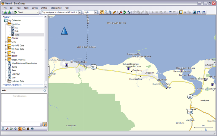
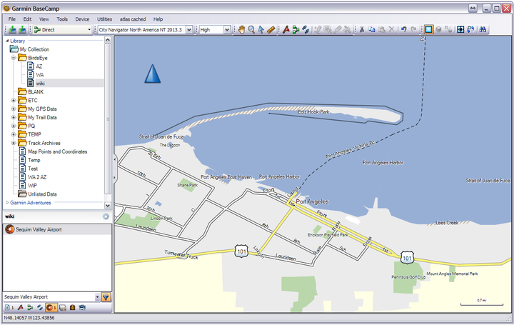
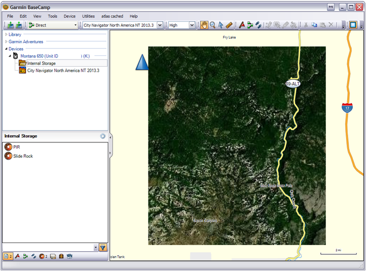
01 Open BaseCamp application: Select map area for BirdsEye imagery download.
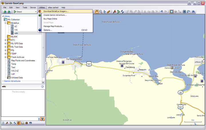
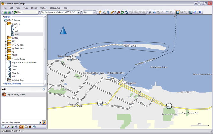
02 Select [Utilities | Download BirdsEye Imagery...]
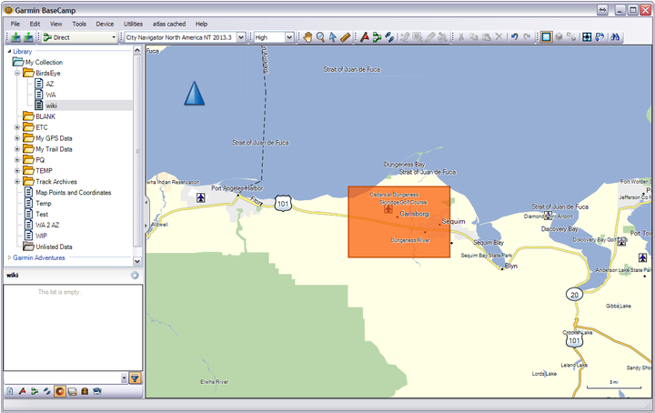
03 BaseCamp will place an orange BirdsEye selection box in the center of the map.
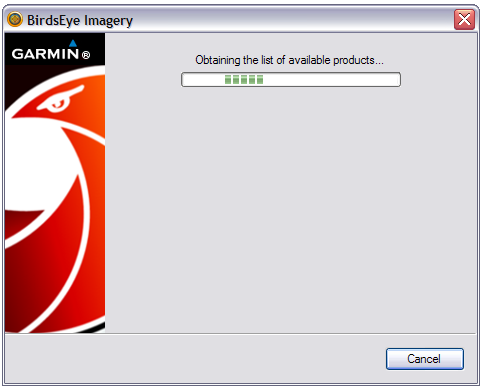
04 BaseCamp checks for available BirdsEye products...
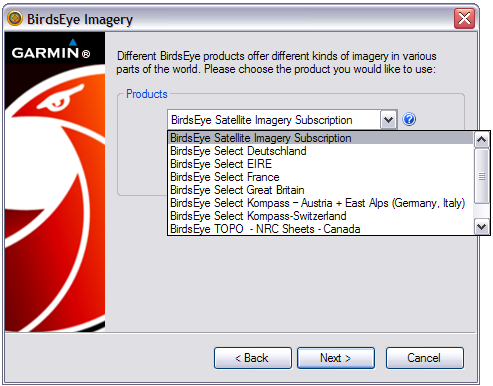
05 Select the desired BirdsEye product from the drop down menu:
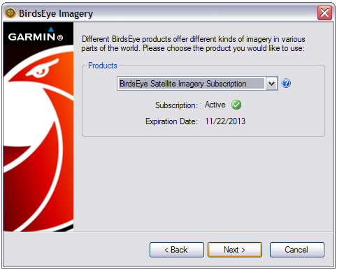
06 BaseCamp verifies subscription status:
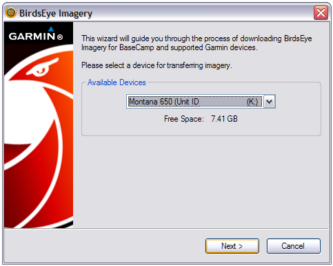
07 Select target device for BirdsEye imagery:
08 BaseCamp generates temporary file name for selected area:
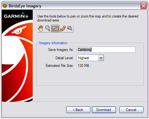
09 Select desired detail level:

10 Use these tools to manipulate the BirdsEye selection area on the map screen:
 |
Pan map |
|
|---|---|---|
 |
==/== |
Zoom in on map (Also mouse scroll-wheel) |
 |
Move/re-size rectangular selection area on map |
|
 |
Draw free-form area on the map |
|
 |
Show entire selected area on map screen |
11 Adjust BirdsEye selection area:
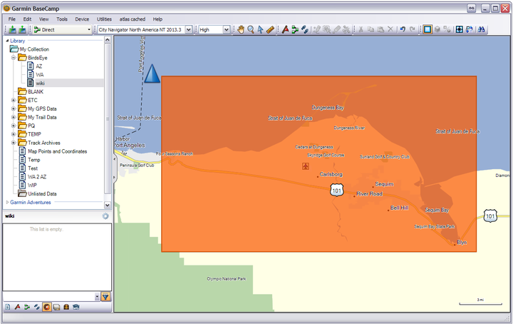
12 BaseCamp alert: "Download size limit exceeded":
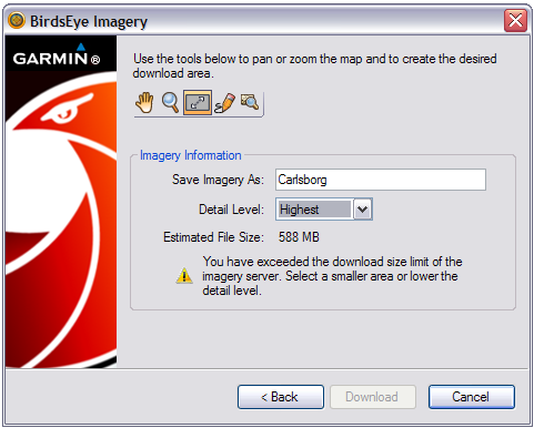
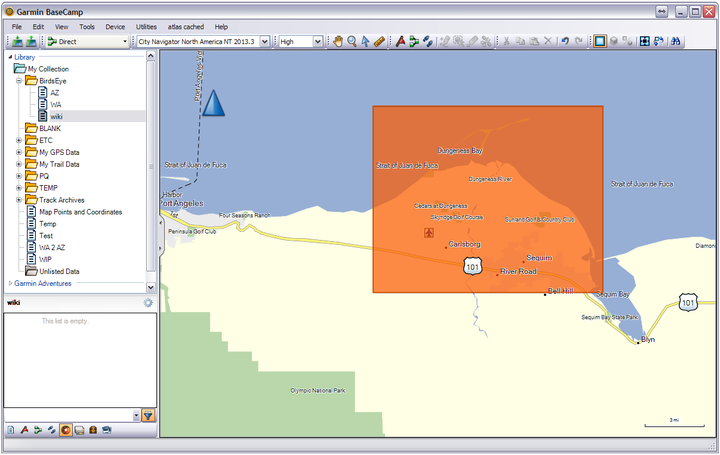
13 Trim BirdsEye selection area to acceptable size:
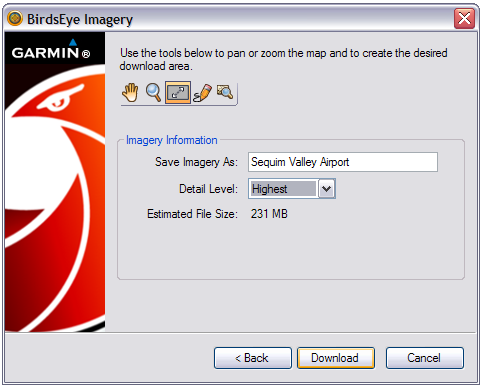
14 Edit BirdsEye file name (if desired) and select [Download]:
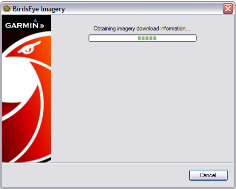
15 BaseCamp contacts BirdsEye imagery servers:
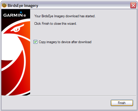
16 BirdsEye imagery download initiated. Choose final options and select [Finish]:
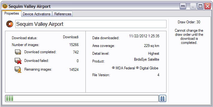
17 BirdsEye map selection download status window:
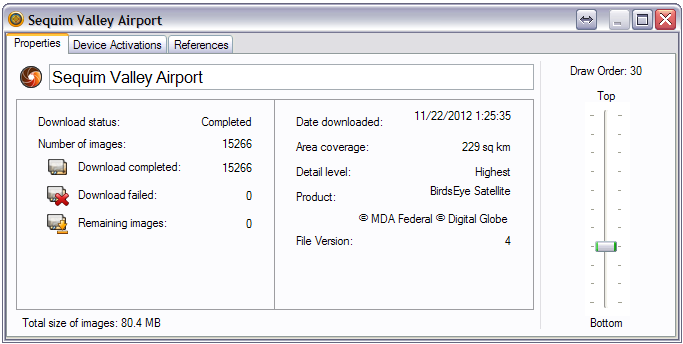
18 BirdsEye download complete! Draw Order can be adjusted if necessary:
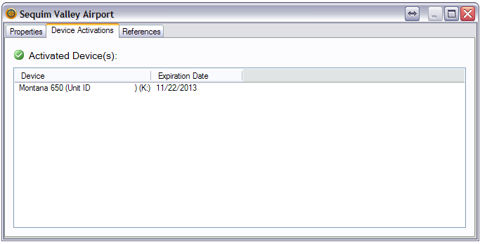
19 List of BirdsEye activated devices:
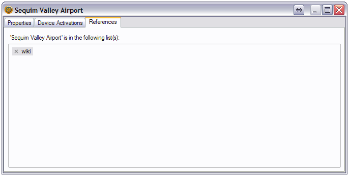
20 All BaseCamp list(s) referencing this BirdsEye map:
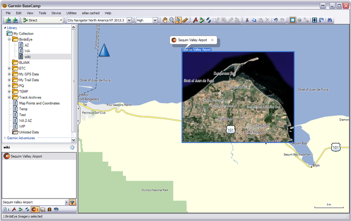
21 View BirdsEye imagery in BaseCamp map:
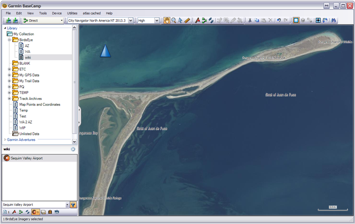
22 Zoom in on BirdsEye map for more detail:
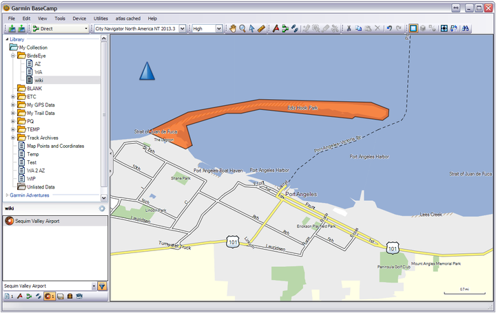
23 Use the Free-Form tool to trace irregular areas for BirdsEye download:
24 Connect the Start and End points:
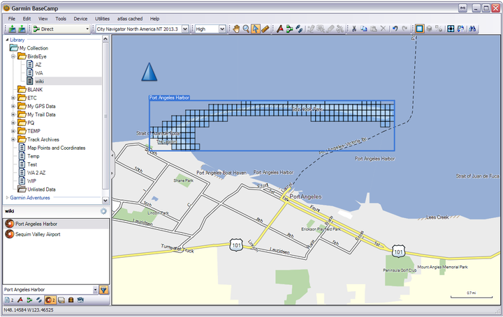
25 BaseCamp selects outlined area for BirdsEye download:
26 BaseCamp highlights map area(s) scheduled for BirdsEye download:
Send BirdsEye to GPSr
Two methods exist to send BirdsEye maps from BaseCamp to your Garmin GPSr:
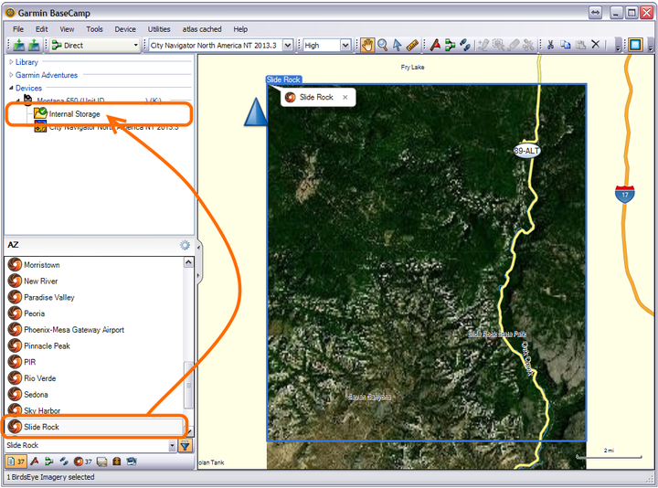
Method 1: Drag 'n' Drop (Hold CTRL to select multiple maps)
Method 2: [Send To] (Hold CTRL to select multiple maps)
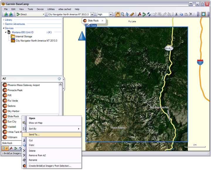
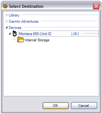
Choose a destination and select [OK]:
BaseCamp transfers the selected BirdsEye map(s) to the selected destination:
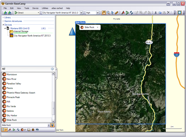
Select your GPSr from the 'Devices' list to view available BirdsEye map(s):
BirdsEye Map Archive
- You will not be able to send BirdsEye maps from BaseCamp to your GPSr after the subscription expires
- BirdsEye maps are stored on your GPSr or µSD card in the [Device]\Garmin\BirdsEye\ directory as *.JNX files
- These *.JNX files are encrypted to the active subscription device selected in step 07
- The GPSr selected in step 07 is the only device that can open and use the encrypted *.JNX files
- Make copies of all *.JNX files on your active subscription GPSr and store them on your computer
- Copy the desired *.JNX files back to your GPSr freely, as often as you need them
- Archived copies of *.JNX files will continue to function after the BirdsEye subscription has expired
Change Draw Order
- This feature is not available for all overlays.
- You can adjust the draw order Garmin BirdsEye images will display on top of one another on the map.
-
Images with higher draw order overlay images with lower draw order.
- Double-click an overlay in the Library and Devices area.
- Adjust the Draw Order slider.